Weather Report – 06/03/2026
Thunderstorms and Heavy Rainfall in the Plains
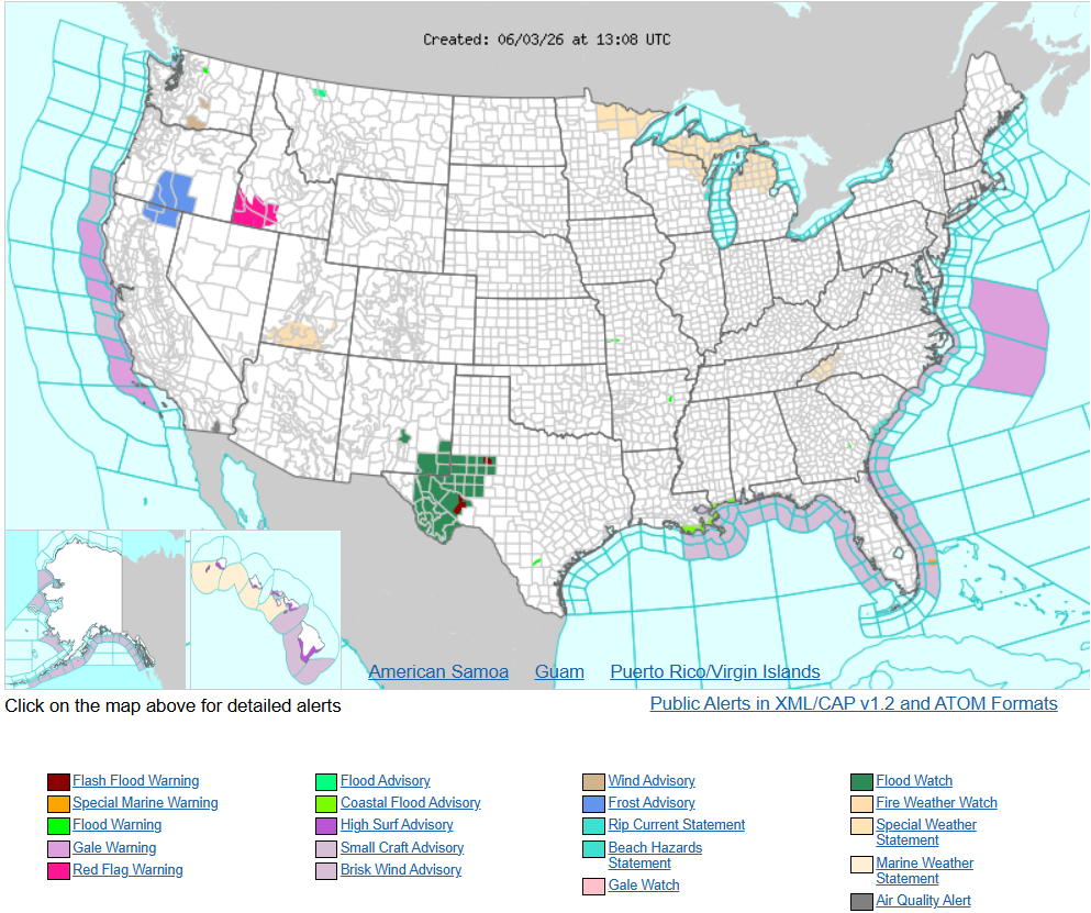
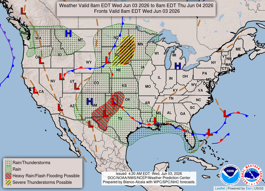
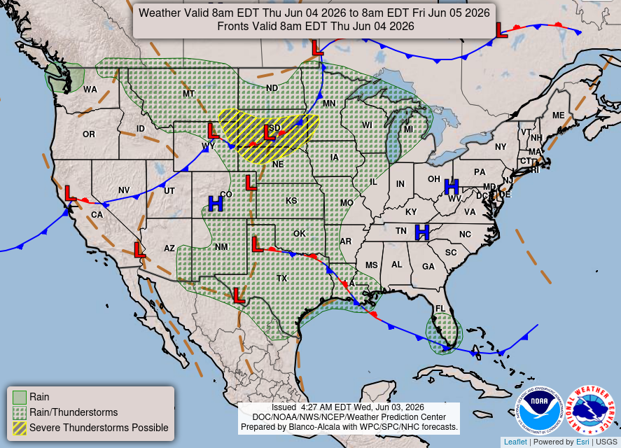
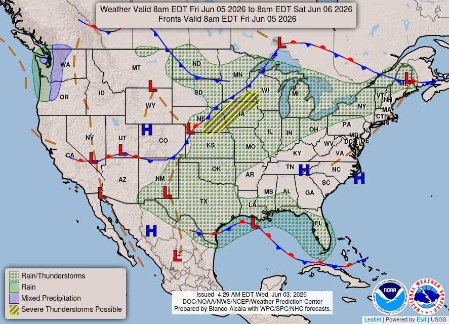
Severe thunderstorms will be possible over parts of the northern Plains today through Thursday which could bring large hail, damaging winds, and possible tornadoes. Thunderstorms with heavy to excessive rainfall may continue to produce flooding over parts of the southern and northern Plains today