
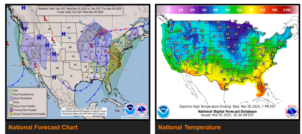
A major low pressure will be making numerous headlines across the Eastern U.S. through the middle of the week as the low center tracks from the greater Chicago metro area to southern Michigan and eventually over southern Quebec by Thursday afternoon. Blizzard conditions are expected northwest of the low center from north of Kansas City to Iowa and up to the Upper Peninsula of Michigan, with several inches of snowfall combined with winds gusting 40-60 mph at times. This will lead to white-out conditions at times, thus causing hazardous driving conditions.
Out across the Western U.S., the next storm system will be arriving across California Wednesday afternoon as an upper-level trough moves in. This will lead to increasing showers across the state and heavy snowfall for the Sierra through Thursday night.
Wyoming
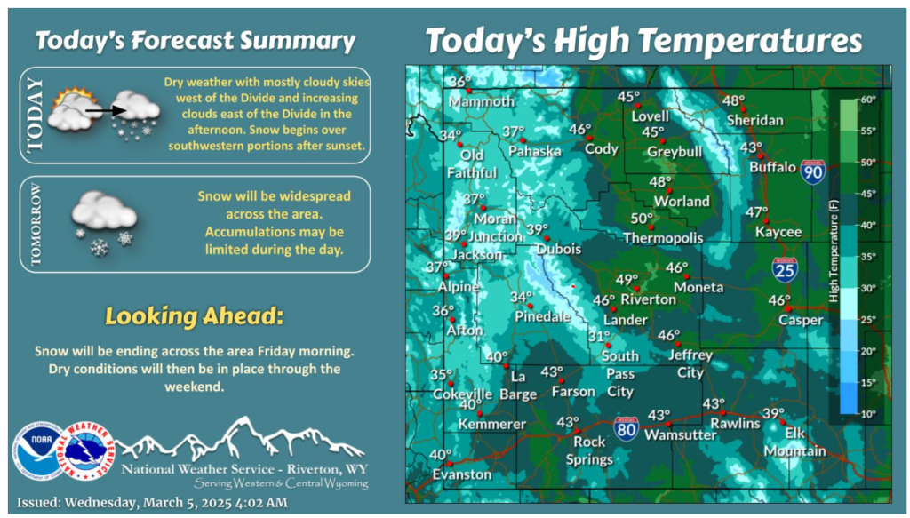
Dry conditions through much of the day, with near seasonal temperatures. Mostly cloudy/overcast skies in place west of the Divide, with increasing clouds east of the Divide late in the afternoon. Snow will redevelop over southwestern portions of the forecast this evening, spreading across central portions through the night.
Stay Safe Out There!