
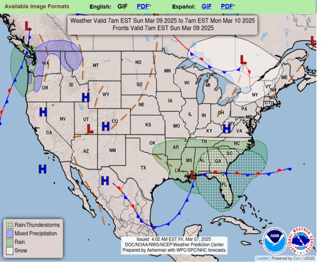
Heavy Snow Friday night into Saturday from the Four Corners to the southern Rockies and nearby High Plains.
Chilly airmass spreads into Southern Plains but very mild across the northern tier and the Southeast.
Critical Fire Weather across parts of the southern High Plains into southwestern Texas.
A swath of mixed rain and snow is forecast from the Midwest to Ohio Valley through tonight, lingering a bit longer into Saturday afternoon along the western slope of the central Appalachians.
By Saturday night into Sunday, moisture from the next Pacific system will be spreading low-elevation rain and mountain snow into the western half of the Pacific Northwest.
Wyoming
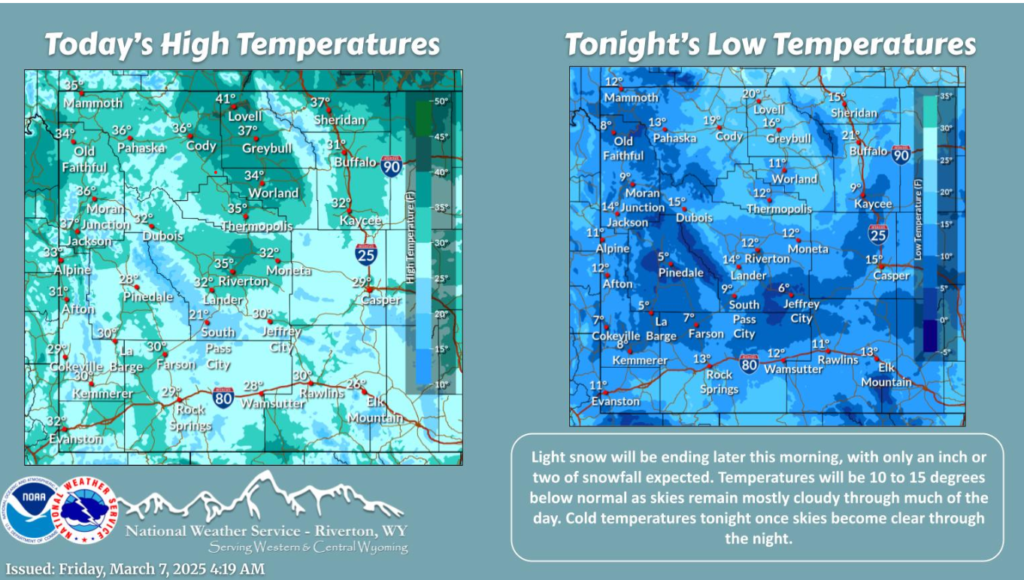
Light snow, with an additional accumulation up to 1″, will continue across areas between Casper and Kemmerer. Temperatures will be 10 to 15 degrees below normal, with lows dropping into the single digits/teens tonight as clouds clear out.
Have a good weekend!