
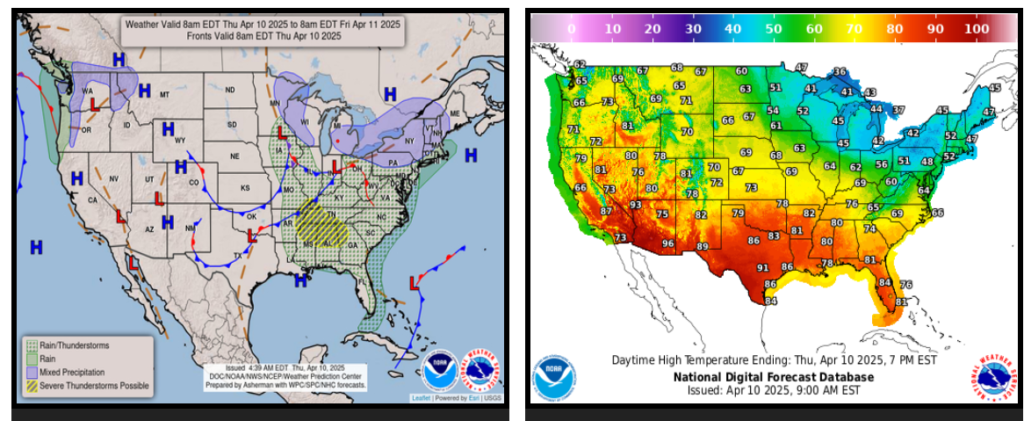
Elevated risk of severe weather from portions of the Lower Ohio Valley and the Mid/Deep South Thursday into parts of the southern Eastern Seaboard Friday.
Mixed rain/wet snow from the Great Lakes to interior New England Thursday will be followed by cold soaking rain showers across the Mid-Atlantic Friday into early Saturday.
Well above normal and near-record warmth builds across the West and into the Plains through the weekend.
Turning cooler and unsettled across the Pacific Northwest.
The main weather story across the United States will be a low-pressure system that is forecast to progressively develop over the Eastern U.S. the next couple of days. This system will gradually strengthen and bring everything from severe weather to widespread cold soaking rain showers, to even a little bit of snow through the early part of the weekend.
WYOMING
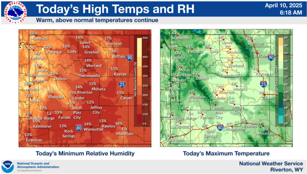
Dry and warm conditions will be in place across the area again today. Winds will generally be light, with high clouds over the area through the day.
NEBRASKA
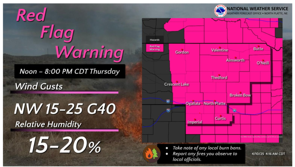
Red Flag Warnings have been issued for much of west central Nebraska on Thursday. The combination of low humidity and strong northwest winds will lead to the rapid spread and erratic behavior of any fire starts.
Have a wonderful day and drive safe out there!