
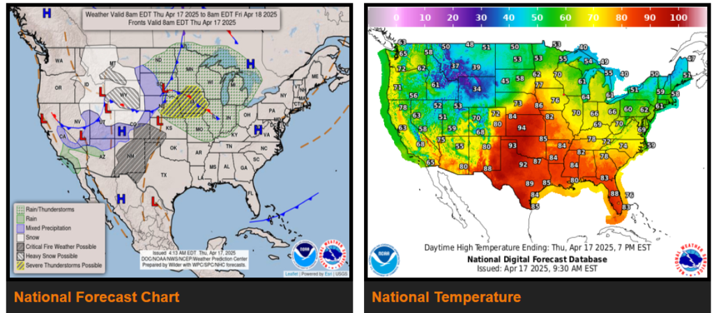
Spring snowstorm to produce heavy snow and strong winds across the Rockies.
Much colder weather to sink south across the Northern/Central Rockies, Great Basin and Northern/Central High Plains, while above average temperature pushes east into the Mississippi & Ohio Valleys.
Critical to Extreme Fire Weather threat for the Central to Southern High Plains.
Severe Weather and Heavy Rain threaten parts of the Central U.S. late this week.
A potent cold front pushing south through the West and Central U.S. will continue to produce heavy snow and strong winds over portions of the Rockies. Heavy snow focuses over southern-central Montana and much of Wyoming today before shifting south into the Colorado Rockies on Friday. Additional accumulations of 1-2 feet (isolated 3 feet) are probable over Wyoming while areas in Colorado could pick up anywhere between 6-12 inches. Frigid air drives southward into the Rockies, Great Basin and High Plains behind the cold front. High temperatures are likely to be 15-30 degrees below average in many of the aforementioned areas through Friday.
The eastern flank of this cold front should become the focus for scattered thunderstorm activity over parts of the Central U.S. beginning today. The Storm Prediction Center issued an Enhanced Risk (level 3/5) of Severe Thunderstorms extending from portions of eastern Nebraska into western Iowa for today.
WYOMING
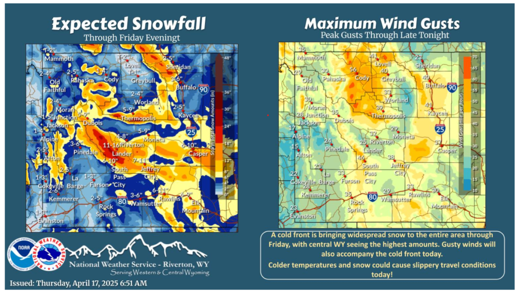
A cold front will bring moderate to heavy snow and gusty winds to much of the area today through midday Friday. Daytime snow accumulations will be limited due to warmer surface temperatures; however, travel conditions could still become slippery!
A winter storm races through the region starting tonight and continuing through early Friday. Warnings and Advisories have been issued for considerable snow accumulation along with gusty north winds.
NEBRASKA
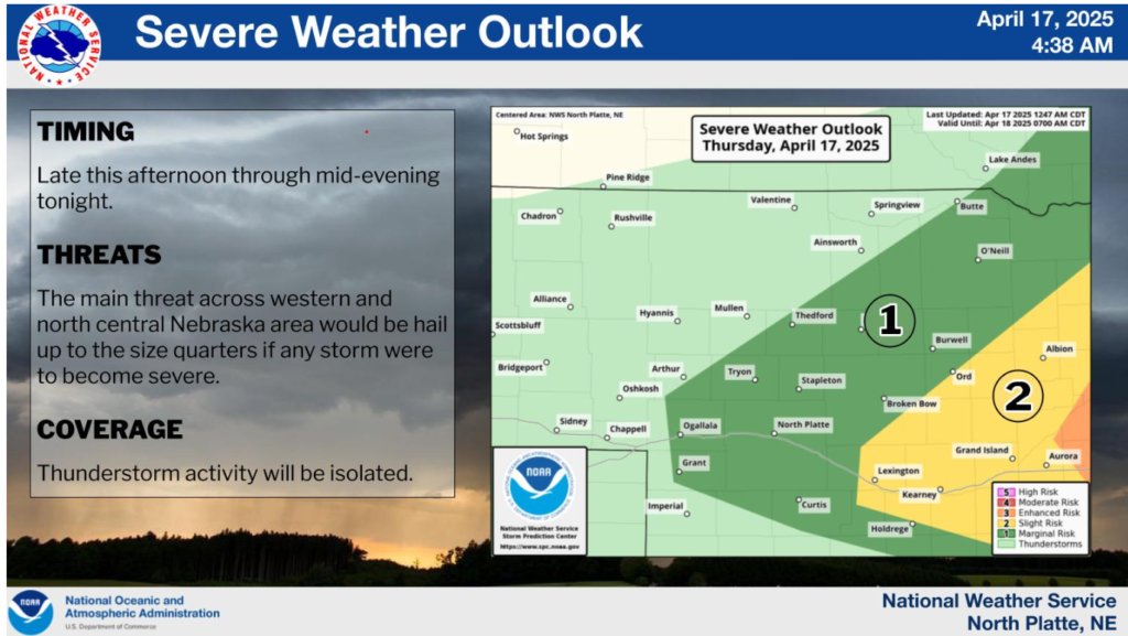
Isolated thunderstorms, with a severe storm possible, are expected to develop late this afternoon and continue through mid-evening before the threat ends. Hail up to the size of quarters will be the main severe threat.
Weather can shift fast—rain, wind, or low visibility can sneak up on you. Please stay alert, drive with caution, and adjust to conditions. Your safety matters most.
Stay safe and have a wonderful day!