
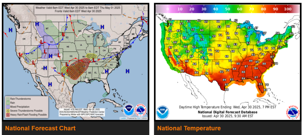
Episodes of heavy rain and severe thunderstorms will keep heightened flash flooding concerns across the south-central U.S. through early Thursday.
Showers and embedded severe thunderstorms expected to shift east into the Mid-Mississippi, Ohio, and Tennessee Valleys on Thursday.
Chance of strong to severe thunderstorms return to the south-central Plains by early Friday morning.
The highest threat of heaviest rain is forecast to shift only slightly to the east today across southeastern Oklahoma into northeastern Texas and western Arkansas where a moderate risk of flash flooding is anticipated.
Meanwhile, a Pacific frontal system moving across the northern Intermountain West, northern Rockies into the northern High Plains is bringing a round of lower elevation rains and accumulating wet snow in the mountains. In the wake of the system and cold front, drier weather moves in later Wednesday into Thursday as high pressure takes control.
WYOMING
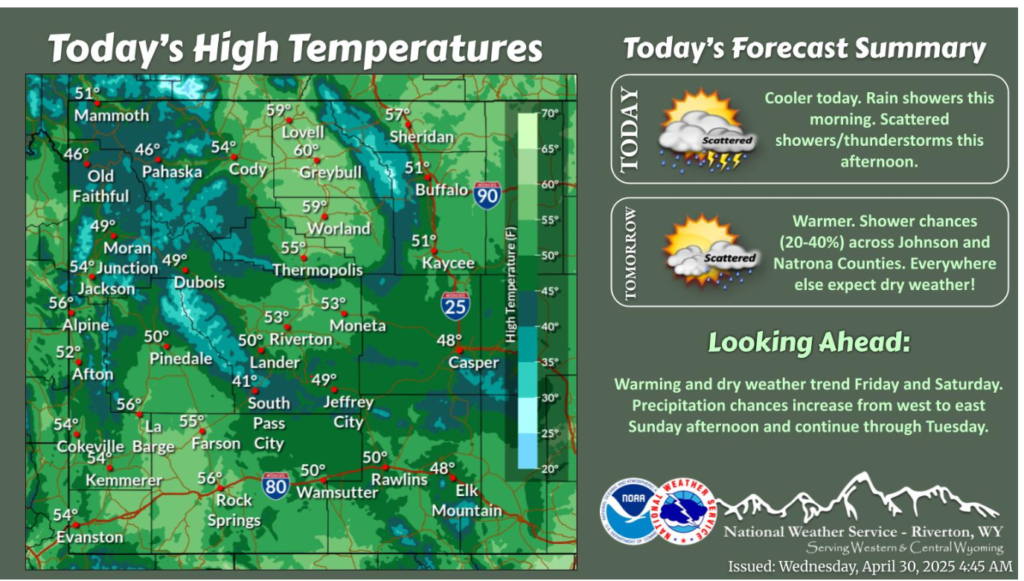
A cooler day is in store as a cold front continues to trek across the area through midday with rain showers. There is another chance (40-70%) of showers and isolated thunderstorms this afternoon and early evening. The gloomy weather won’t last long with a warming and dry trend this weekend!
A cold front swings through the area today, bringing rain showers and gusty north winds at times. Highs remain relatively mild east of I-25, while snow returns to the mountains.
MIDWEST
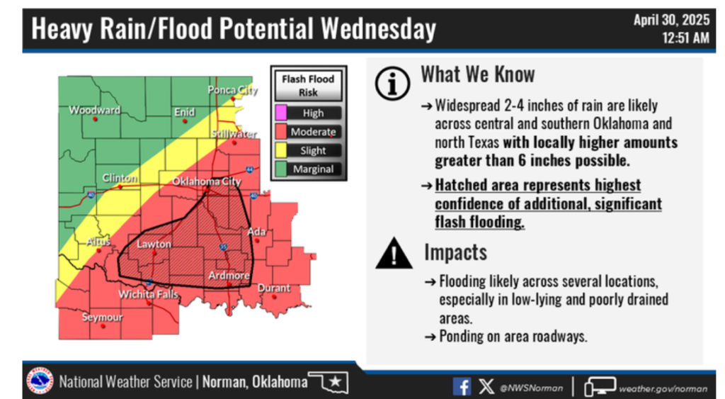
IGNIFICANT FLOODING RISK is expected Wednesday, especially for portions of central and southern Oklahoma. If you encounter flooded roads, turn around don’t drown!
Have a nice and safe day.