
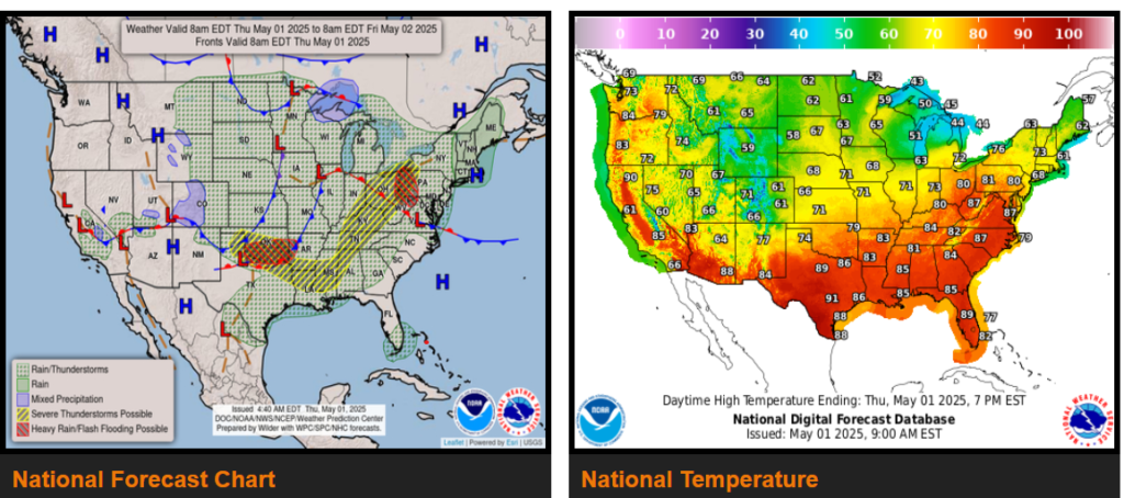
Showers and embedded severe thunderstorms shift east into the Mid-Mississippi, Ohio, and Tennessee Valleys today as rain overspreads the Great Lakes through tonight.
Potential for strong to severe thunderstorms returns for the southern Plains on Friday.
A low-pressure system forming along a stalled frontal boundary across the southern Plains will gradually intensify as it tracks northeastward across the Mid-Mississippi Valley and the Midwest today before reaching the Great Lakes tonight.
On the other side of the system however, showers and embedded severe thunderstorms will increase and expand across Mid-Mississippi, Ohio, and Tennessee Valleys today.
Meanwhile, a Pacific frontal system is bringing a round of wet snow and lower-elevation rains and across the Colorado Rockies this morning. Additional disturbances associated with a digging trough will bring scattered rain showers across the northern and central High Plains today.
WYOMING
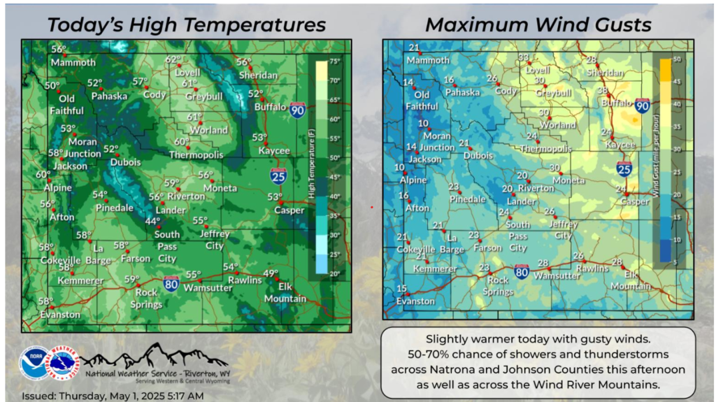
To ring in the first day of May, expect slightly warmer temperatures and breezy to gusty winds. There are shower and thunderstorm chances (50-70%) across Natrona and Johnson Counties and across the Wind River Mountains this afternoon.
EASTERN OKLAHOME AND NORTHWESTERN ARKANSAS
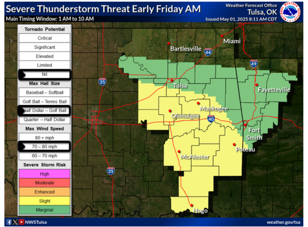
A strong upper-level disturbance diving southeastward into the Plains Thursday night into Friday morning will force a complex of thunderstorms into the region. A Slight Risk for severe weather exists in parts of eastern Oklahoma south of Highway 412 from after midnight Thursday night into mid-morning Friday. Damaging winds will be the primary threat, but isolated large hail may also occur. Locally heavy rainfall potential will also exist Thursday night into Friday.
Be safe out there and have a fantastic day!