
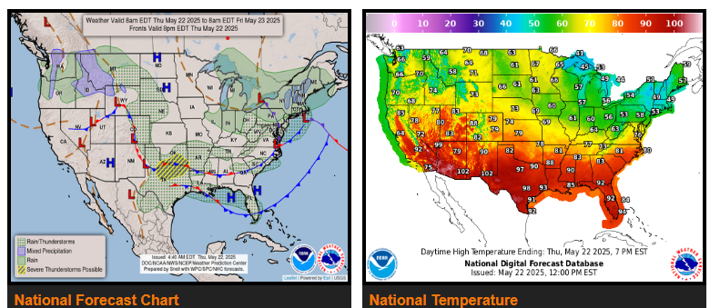
Severe weather potential in Southern Plains today; cold and rainy in the Northeast.
Above average temperatures across southern tier states and West; below average temperatures from Northern Plains to Northeast/Mid-Atlantic.
A relatively stagnant upper pattern with troughing along the coasts and ridging over the Central U.S. will persist through the end of the week. Low pressure in the East will produce cool and rainy weather from the Ohio Valley to the Northeast/Mid-Atlantic.
WYOMING
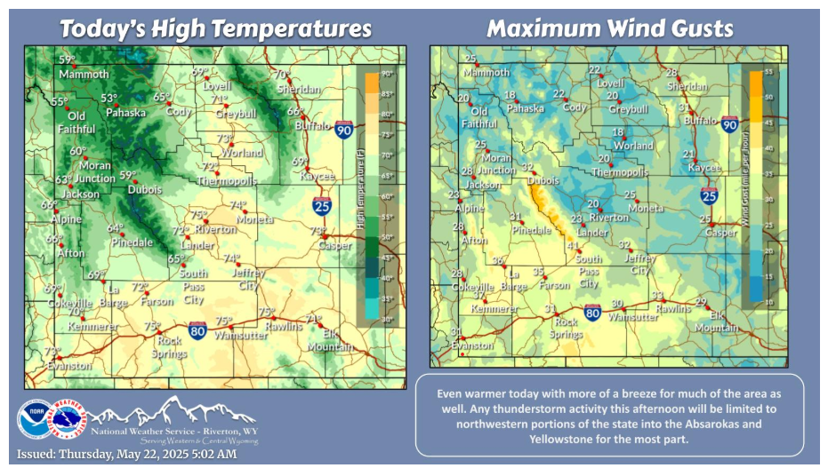
Warmer and a bit breezier this afternoon with some limited thunderstorm activity for points in northwestern portions of the state.
NEBRASKA
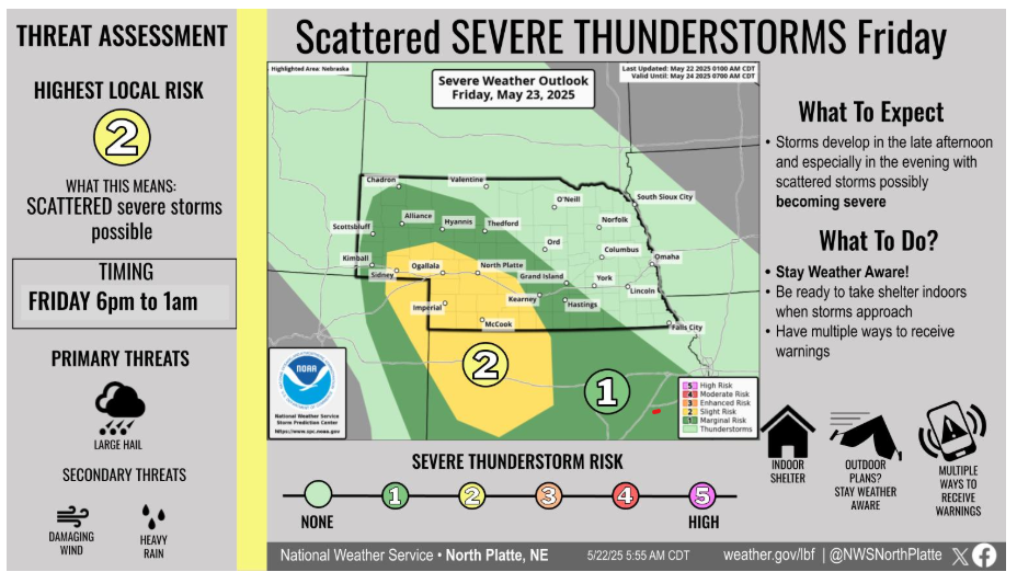
Thunderstorms with scattered severe storms possible are likely, especially Friday evening. Large hail to the size of quarters and gusty, possibly damaging winds could develop.
OKLAHOMA
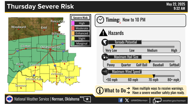
Some severe storms will be possible this morning into the evening hours across portions of OK and western north TX. Large hail and damaging winds will be the primary concerns.
Have good day and drive safe out there!