
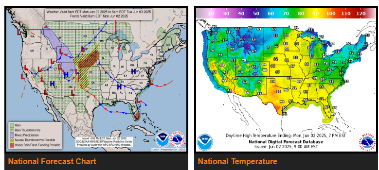
Moderate to heavy rain will be moving across the Southwest and Four Corners today with flash flooding possible.
Heavy rain, severe weather, and flooding threat develop today over the north-central Plains, shifting to the south-central Plains and toward the upper Midwest on Tuesday.
Tropical moisture is expected to become more focused across South Florida and then spread northward through the next couple of days.
A strong cold front originating from the Pacific continues to shove the recent spell of heat in the western U.S. into the mid-section of the country. Meanwhile, a batch of moderate to heavy rain ahead of an upper-level low across the Desert Southwest early this Monday morning and is forecast to overspread the Four Corner and the central/southern Rockies for the remainder of today.
Tuesday will find the strong cold front pushing farther eastward, leading to the heavy rain, severe weather, and flooding threat shifting into the south-central Plains and toward the upper Midwest. The trailing portion of the front will then dip into Texas by Tuesday evening.
WYOMING
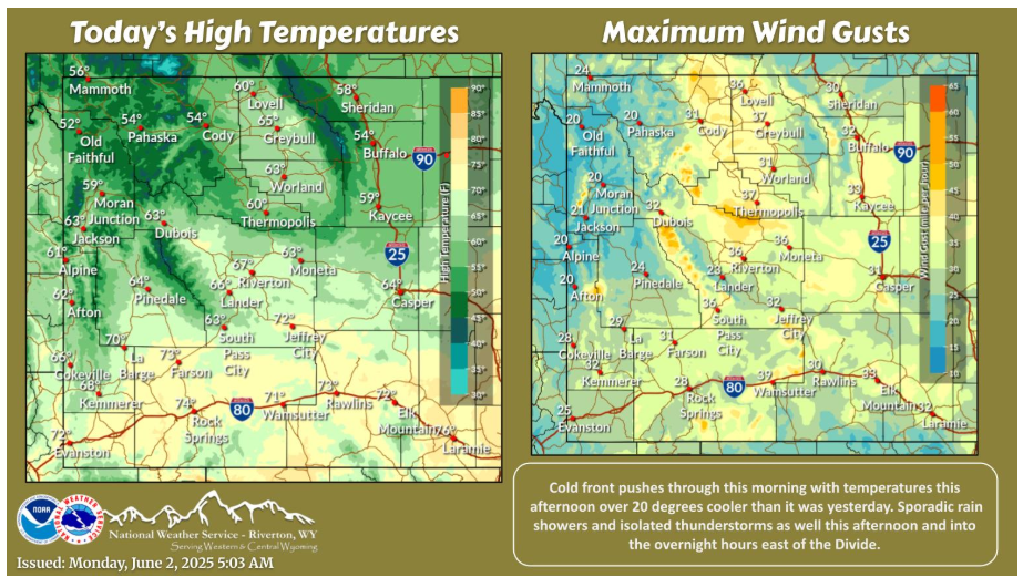
Cold front this morning brings cooler temperatures this afternoon with some gusty northwest to northeast winds behind it. Some scattered rain showers and isolated thunderstorms as well today, mainly east of the Divide.
COLORADO
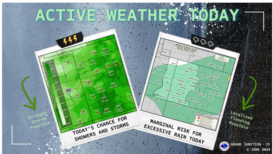
A surge of tropical moisture will move into eastern Utah and western Colorado today, bringing widespread showers and thunderstorms. The Weather Prediction Center has nearly the entire region in a Marginal Risk for excessive rainfall today. Localized flash flooding will be a concern. However, there is still uncertainty regarding storm strength and coverage during the afternoon, as the amount of morning cloud cover could help or hinder afternoon storms. Be sure to stay tuned for forecast updates as the day goes on.
NEBRASKA
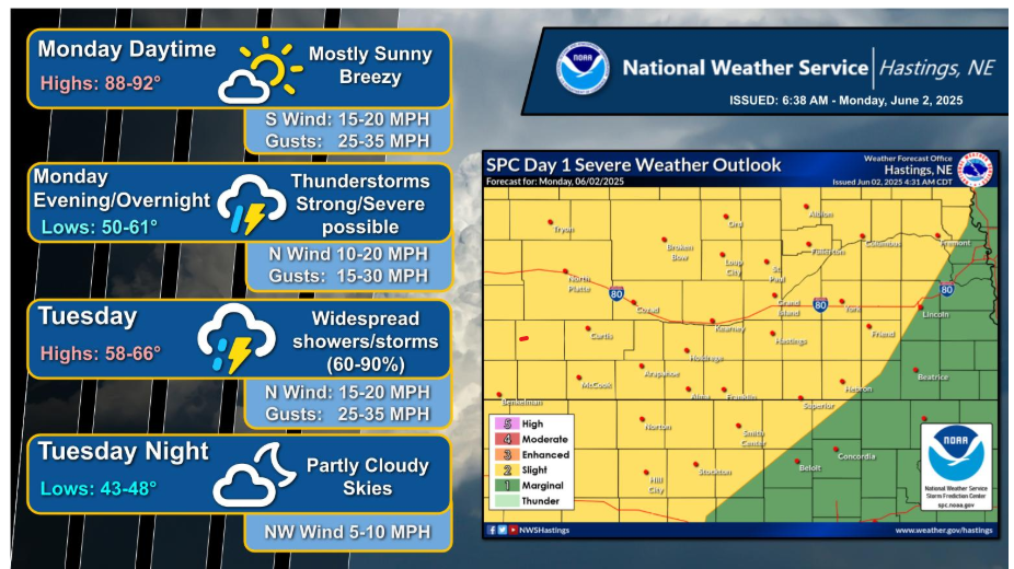
Strong to severe thunderstorms are possible across the area mainly during the evening to overnight hours (6pm-1am). A line of thunderstorms is expected to develop along a cold front across northwestern portions of the area this evening, and move southeast across the area. Storms will be capable of producing damaging wind gusts (60-70mph), large hail (quarter to golf ball sized) and a brief tornado can’t be ruled out. Locally heavy rainfall is also possible with these storms, mainly across northwestern portions of the area, where accumulations of 2-4” are possible.
Stay alert and safe out there,
Have a fantastic day!