
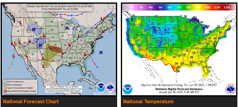
Heavy showers and severe thunderstorms are expected to redevelop tonight across the central Plains and nearby High Plains where flash flooding is possible.
Another round of heavy showers and severe thunderstorms is expected to impact the south-central Plains and nearby High Plains Friday night into early Saturday where flash flooding is possible.
Tropical moisture associated with a coastal low-pressure system is forecast to bring some heavy rainfall today near the Carolina coastline and portions of the Florida Panhandle.
An upper-level trough that has already brought heavy rain and thunderstorms across many locations of the Southwest into the Four Corners is forecast to weaken today.
WYOMING
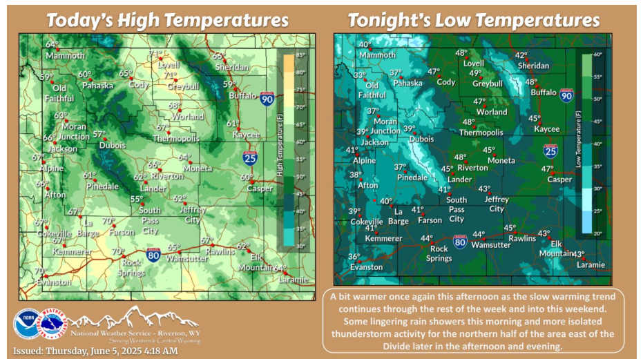
Warming trend continues this afternoon as lingering rain showers end this morning ahead of some more isolated thunderstorm activity later in the afternoon and evening. Relatively light winds and more ample sunshine expected as well.
NEBRASKA
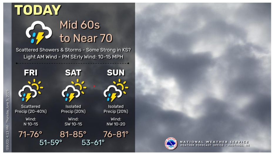
An unsettled upper level pattern will keep chances for at least scattered showers and thunderstorms in the forecast for the end of the work week, with chances decreasing into the weekend. For today, thunderstorm chances return this afternoon and evening, and there is the potential for a few to be on the stronger side across portions of north central Kansas, but the main focus for severe weather looks to be south of our forecast area. Highs today only top out in the 60s to near 70, but 80s return for this weekend.
OKLAHOMA
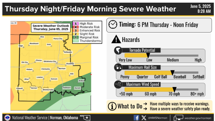
Severe storms are possible Thursday during the late evening through the overnight hours into Friday morning with large hail, damaging winds, and a few tornadoes as the primary hazards.
NEBRASKA

Scattered to numerous thunderstorms are expected Thursday and Thursday night. Locally heavy rainfall is expected, with up to 2 inches possible. Some storms are expected to be severe, producing large hail and damaging winds.
Have a fantastic day!