
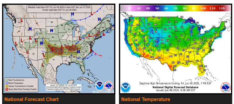
Episodes of severe thunderstorms on tap for portions of the central and southern High Plains, the Tennessee and Ohio Valleys, southern New England, and into the Southeast Friday and Saturday.
Heavy showers capable of producing instances of flash flooding expected across portions of the central/southern High Plains eastward into parts of the Tennessee Valley, Mid-South, and southern New England into the weekend.
Below normal temperatures in store from the Rockies into the Great Lakes while heat builds across the Southern U.S. and the Pacific Northwest through Saturday.
Cooler than normal temperatures from parts of the Rockies and the Intermountain West eastward to the Great Lakes through Saturday. The coolest temperature anomalies will be found from southeast Wyoming and western Nebraska to eastern Colorado and western Kansas today with high temperatures 10 to 15 degrees below normal.
WYOMING
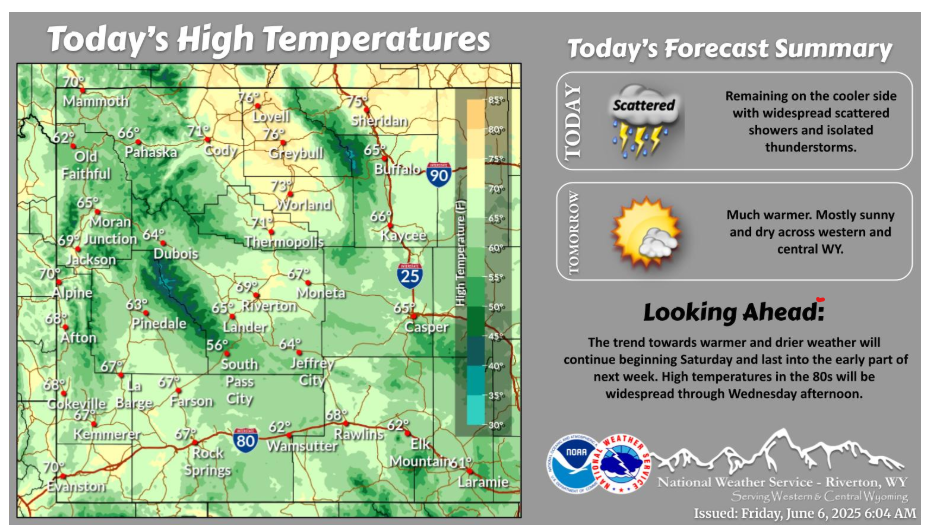
Remaining cool today with scattered showers and thunderstorms possible through the afternoon. Showers diminish after sunset and a drying and warming trend will start on Saturday. The warm and dry conditions continue into the middle of next week.
NEBRASKA
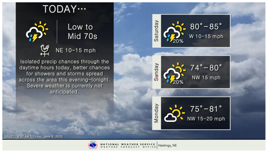
Isolated showers and weak thunderstorms are not out of the question during the daytime hours today, but many locations will likely end up being dry. Better chances for showers and thunderstorms spread across the area this evening-tonight, with the best chances being across the southern half of the area. A few stronger storms are possible across north central Kansas, but the best potential for severe weather looks to focus to the south of our forecast area. Spotty shower and thunderstorm chances continue into this weekend, with a drier forecast for the start of the new work week. Highs today are in the low to mid 70s, with mid 70s to mid 80s expected this weekend into Monday.
KANSAS
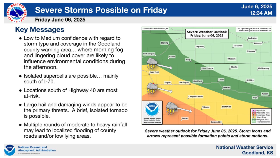
Severe storms are possible across portions of the area Friday afternoon (June 06, 2025) — mainly along and south of a line from Yuma County, CO to Gove County, KS between 3-10 PM MDT / 4-11 pm CDT. Large hail and damaging winds appear to be the primary threats. A brief, isolated tornado is possible. Locations south of Highway 40 are most at-risk. Low to Medium confidence with regard to storm type and coverage in the Goodland county warning area… where morning fog and lingering cloud cover are likely to influence environmental conditions during the afternoon.
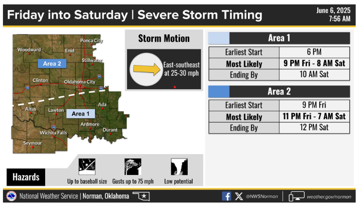
Severe storms are expected Friday evening into Saturday morning. A line of storms will move to the east-southeast across the area tonight, generally moving out of the area by 12 PM Saturday.
Have a wonderful weekend.