
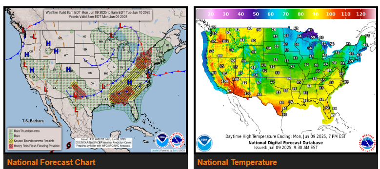
Active severe weather setup from the southern Plains to the Mid-Atlantic through Tuesday.
Stifling heat dome to build in throughout much of the West and the western Gulf Coast; hottest temperatures compared to normal centered over the Northwest.
Potential for strong to severe thunderstorms to develop across portions of the Deep South and extending northward to the central Appalachians on Monday. The Storm Prediction Center has a Slight Risk of severe thunderstorms from near New Orleans to western New York. There will likely be scattered multi-cell clusters and some supercells, with damaging winds and large hail the primary threats, and some tornadoes are also a possibility.
Another area of stormy weather is expected to be across western Texas and eastern New Mexico on Monday, where a broad Marginal Risk and embedded Slight Risk of severe weather is valid, but not as widespread as what happened Sunday evening across Texas.
Elsewhere across the Continental U.S., widespread anomalous heat will continue to affect interior portions of the Pacific Northwest through Tuesday with heat advisories in effect from northern California to eastern Washington and northern Idaho, and daily record highs are likely for some areas.
WYOMING
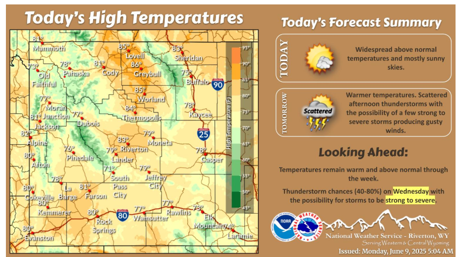
Today, expect mostly sunny skies and warm temperatures! The next chances for showers and thunderstorms will be Tuesday and Wednesday. There is potential for storms to become strong to severe both days with a greater chance for strong to severe storms on Wednesday.
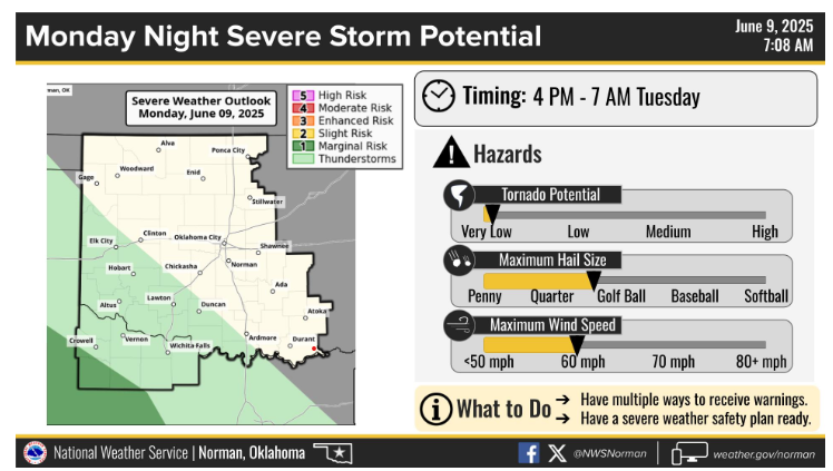
A cluster of strong to severe storms will impact parts of west Texas Monday night into early Tuesday morning. This cluster could clip parts of western north Texas.
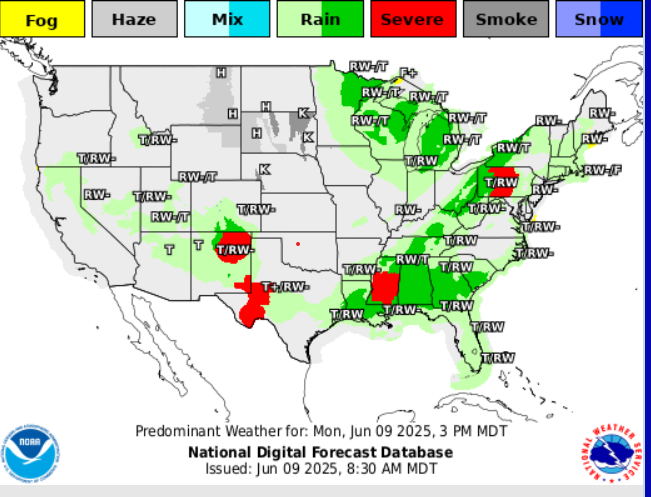
PREDOMINANT WEATHER
Have a fantastic day!