
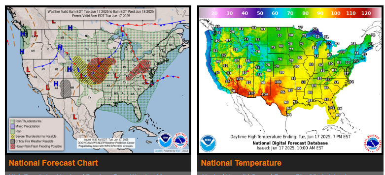
Flash flood threat for the central Appalachians, central Plains, and the Midwest Tuesday & Tuesday night.
Severe thunderstorm risk for the central U.S. Tuesday, Midwest & lower Great Lakes on Wednesday, & the Mid-Atlantic States Thursday.
Fire weather concerns for portions of the West & Rockies through Thursday…Significant heat in the Southwest this week…Heat builds in the East.
Wednesday when the threat of severe thunderstorms will shift farther south and east from the southern Plains across the Midwest/Ohio Valley and into the lower Great Lakes. In addition to the severe weather threat, a heavy rain/flash flooding threat is expected from portions of the east-central Plains into the Midwest on Tuesday and Tuesday night.
As the initial progressive upper level disturbance moves through the West, a fire weather risk shifts southeast across portions of Arizona, the Four Corners, and into the far southern Rockies Tuesday under a dry, gusty west to northwesterly wind. Red Flag Warnings are in effect for a large portion within these areas.
WYOMING
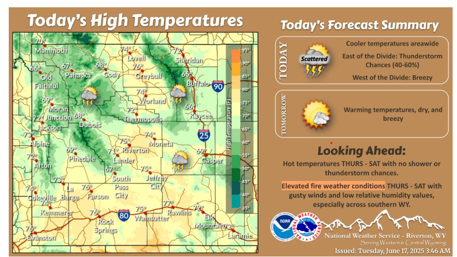
Cooler temperatures today with thunderstorm chances, primarily east of the Divide. Tomorrow begins the first day of a warm up to summer temperatures. Elevated fire weather conditions are forecast Thursday – Saturday, especially across southern WY.
NEBRASKA
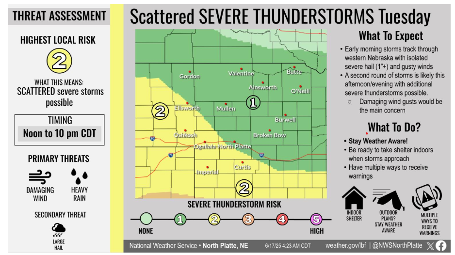
Scattered severe storms are possible Tuesday, especially across southwest Nebraska. Expect a couple rounds — one in the morning and another in the afternoon and evening. Damaging wind gusts and heavy rain will be the main threats, though isolated hail can’t be ruled out. This second round remains a little more uncertain and will require adequate clearing behind the first round. Stay alert and have multiple ways to get warnings!
Let’s keep up with the weather alerts—stay safe and have a good day!