
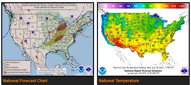
Severe thunderstorm risks for the Midwest & lower Great Lakes on Wednesday, & the Mid-Atlantic States Thursday.
Fire weather concerns and/or significant heat for portions of the West, Rockies, & Central High Plains through Friday.
Heat builds in the East through Thursday.
A wave of low pressure wave in the Plains is forecast to intensify and track northeast through the Midwest on Wednesday, which brings a threat of severe thunderstorms and flash flooding from the southern Plains across the Midwest/Ohio Valley and into the Great Lakes.
The combination of windy and dry conditions brings an elevated fire weather threat across interior portions of the Northwest on Wednesday (where Red Flag Warnings are in effect), which shifts into the Great Basin on Thursday and Friday (Red Flag Warnings are in effect for much of Utah).
WYOMING
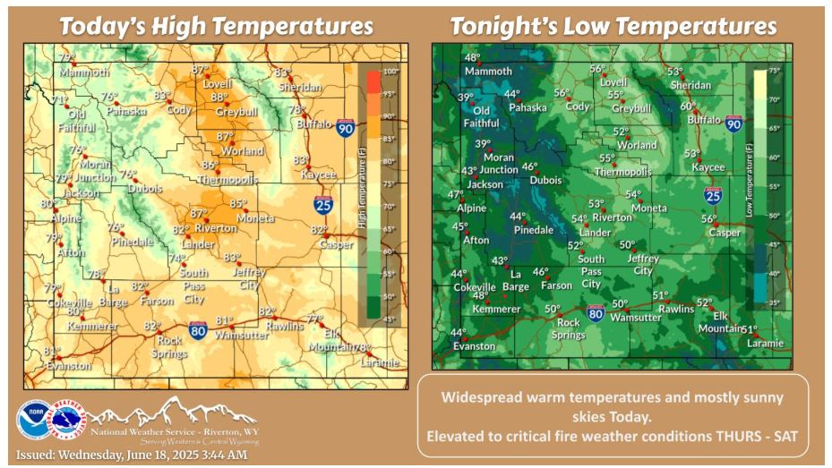
A warm and dry day is in store today with mostly sunny skies! Hot temperatures arrive Thursday along with gusty winds and low humidity, resulting in elevated to critical fire weather conditions.
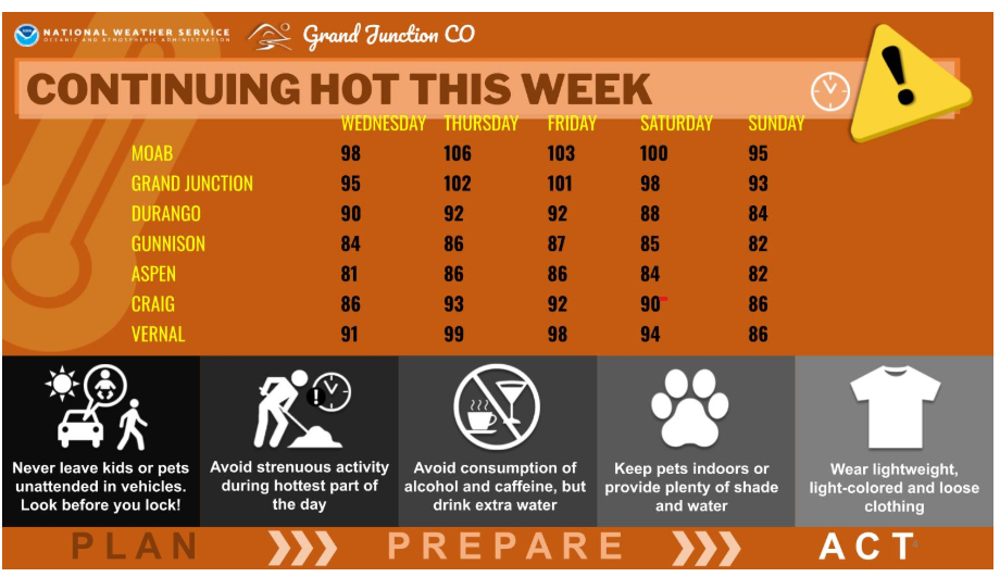
Temperatures are expected to climb to 10-15 degrees above normal for late June by Thursday and Friday, with triple digit heat expected across the desert valleys. Widespread critical fire weather conditions will return from Thursday onward thanks to increasing southwesterly winds ahead of an approaching low pressure system. The cool front associated with that system reaches us on Sunday, bringing something of a reprieve from the heat as high temperatures return to more seasonable values.
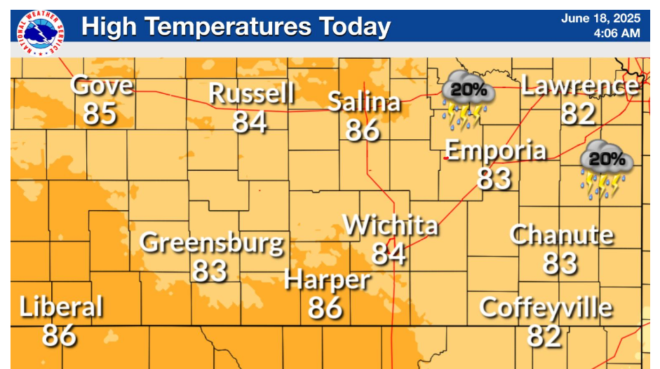
Showers and storms across southeast Kansas will come to an end later this morning. Temperatures will rebound into the 80s for the entire area. A stray shower or storm is possible across northeast Kansas this afternoon.
Stay hydrated and safe out there!