
Severe thunderstorms to envelope much of the East today; daily rounds of severe weather are expected across the Northern Plains, Upper Midwest, & Great Lakes through Friday
Searing heat continues in the Southwest, Intermountain West, and High Plains.
The origins of a dangerous central and eastern U.S. heat wave kicks off this weekend in the Midwest.
Fire weather a concern for portions of the West & Rockies through Friday.
Multiple rounds of severe weather are expected across the northern and eastern U.S. through the end of the week. Today, the spotlight for severe weather potential shines brightest along the East Coast with the Mid-Atlantic and Northeast regions most at risk. This is due to a cold front that will spark numerous showers and thunderstorms from the Mid-South to as far north as northern Maine.
Expanding heat wave that has a tight grip over the Southwest, the Rockies, and northern High Plains today. Extreme Heat Warnings are out for Las Vegas and Phoenix today and Friday while Heat Advisories have been issued for cities such as Denver, Salt Lake City, Albuquerque, and El Paso. By Friday, an approaching upper-level low will cause temperatures to plummet to below normal levels from the Pacific Northwest on south along the California coast.
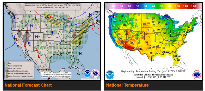
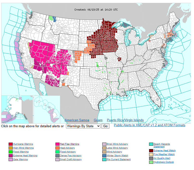
A heat advisory is in effect for much of the West, Southwest, and Northeast regions. Please take extra precautions—stay hydrated, avoid prolonged sun exposure, and find ways to stay cool throughout the day.
Let’s take care of ourselves and each other. Stay safe out there!