
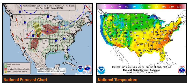
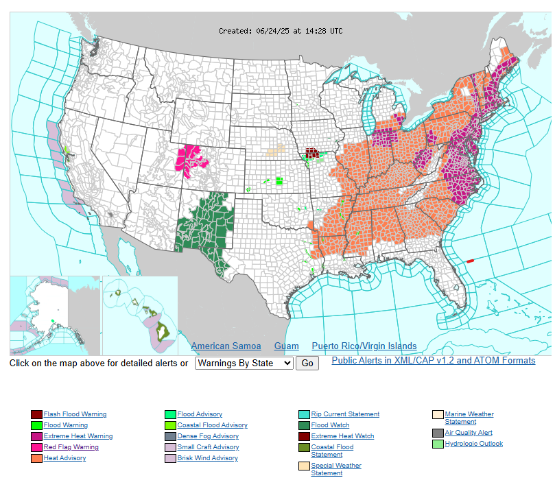
Extremely dangerous heat persists from the Midwest to East Coast this week.
There is a moderate risk of excessive rainfall leading to flash flooding across much of central New Mexico today.
Additional excessive rainfall and severe thunderstorm concerns from the Front Range to the Midwest.
A strong upper ridge centered over the East will generate a dangerous heat wave this week. Extreme heat warnings and/or heat advisories currently extend from the Lower Mississippi Valley and Midwest to the East Coast, affecting nearly 160 million people.
Extreme heat is expected to last through much of this week with the longest duration of well above average temperatures centered over the eastern Ohio Valley into Friday.
Another area of concern is in the Central U.S., where an upper trough with shortwave energy riding along its leading edge will produce thunderstorms and heavy rainfall.
There’s a slight risk of excessive rainfall extending from northeastern Colorado to southern Wisconsin/northern Illinois today. Moisture presence increases on Wednesday, so a higher end slight risk is in effect from southern Nebraska to eastern Wisconsin.
WYOMING
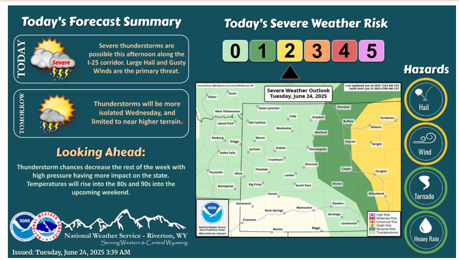
Strong to severe thunderstorms are expected today, with the greatest threat along and east of I-25. The main threat with the strongest storms will be large hail and gusty winds. Thunderstorms are also expected farther west in the state, but the potential for strong storms is much lower.
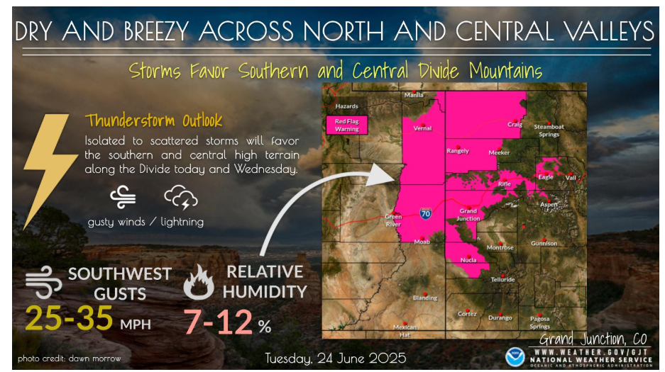
Dry and breezy conditions will occur across the northern and central valleys leading to critical fire weather conditions with Red Flag Warnings in place. Moisture increases along the Divide with isolated to scattered coverage of storms favoring the high terrain. Gusty winds and lightning remain the main concerns with low chance of wetting rain.
Have a good day!