
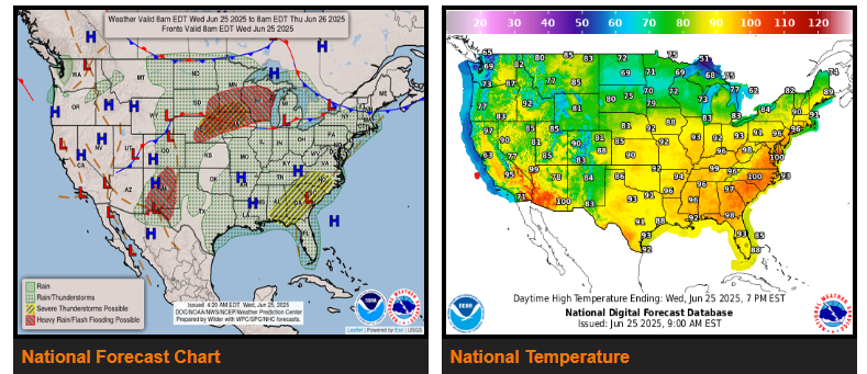
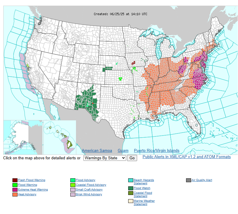
Extremely dangerous heat persists across the Midwest and East Coast.
Excessive rainfall concerns for portions of the Southwest, Southern High Plains, Northern/Central Plains today.
Severe thunderstorms and excessive rainfall potential across the Upper/Middle Mississippi Valley, Upper Great Lakes, and Southeast through Thursday.
Extreme heat warnings and/or heat advisories currently extend from the Lower Mississippi Valley and Midwest to much of the East Coast, affecting nearly 150 million people. The Ohio Valley will experience the longest stretch of extreme heat as it is likely to persist through Friday.
WYOMING
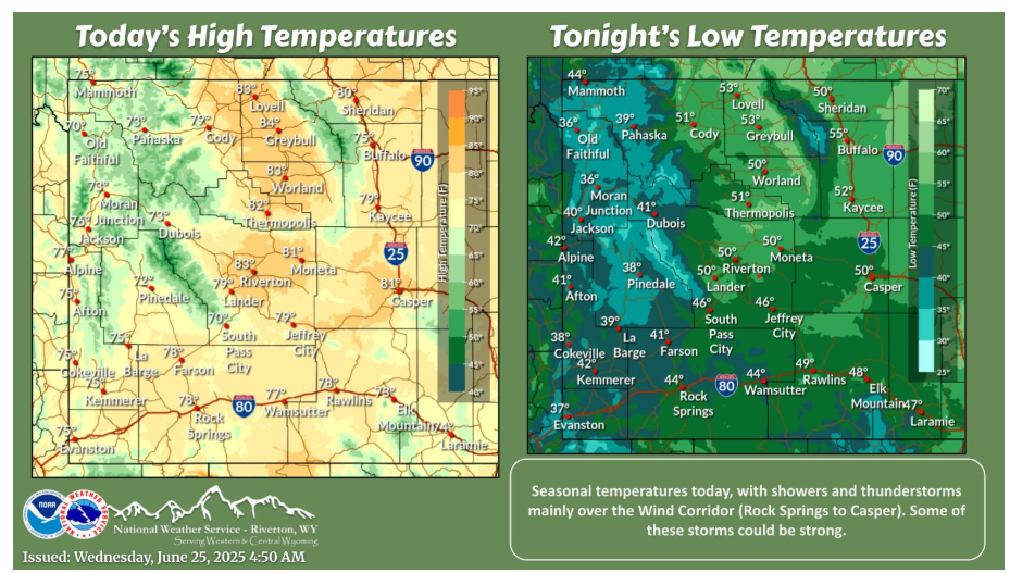
Seasonal temperatures today. The best chances for showers and thunderstorms this afternoon will be along and east of a Rock Springs-to-Casper line. These storms are expected to end over the area by sunset.
NEBRASKA
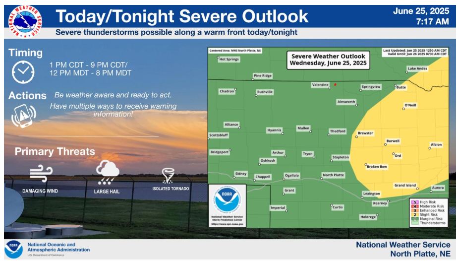
There is a slight risk for severe thunderstorms later this afternoon and tonight mainly from central into eastern Nebraska. Large hail and damaging wind gusts are the main threats. A tornado or two cannot be ruled out.
Stay weather-aware out there and have a safe, good day