
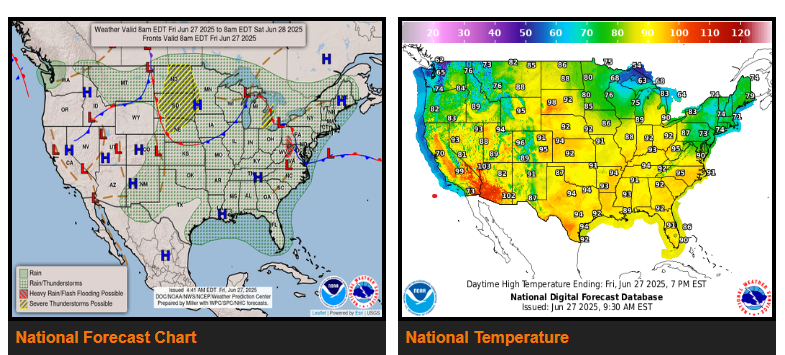
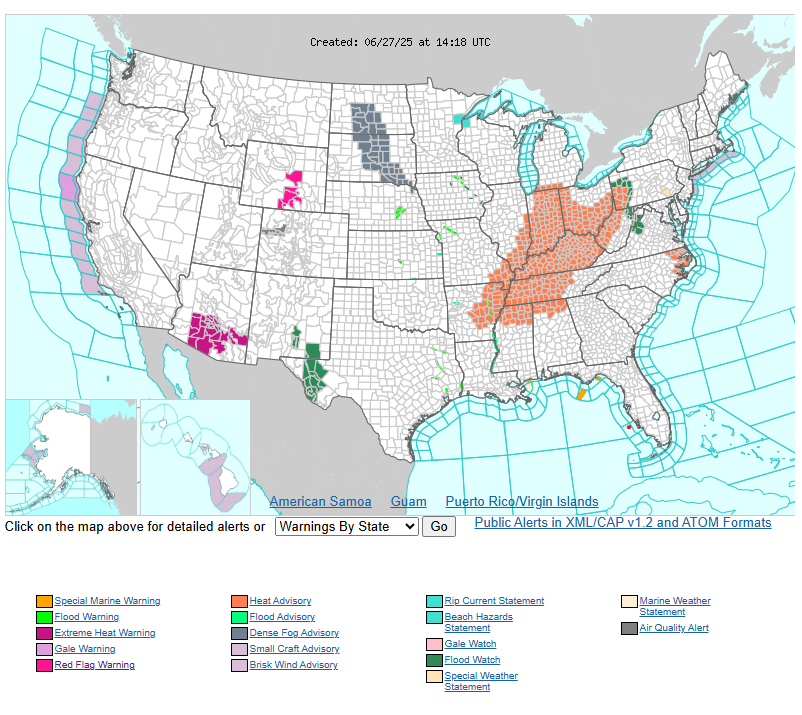
There are Heat Advisories across much of the Ohio/Tennessee Valleys and Middle /Lower Mississippi Valley.
There is a Slight Risk of excessive rainfall over parts of the Central Appalachians and northern Mid-Atlantic on Friday.
There is a Slight Risk of severe thunderstorms over parts of the Northern/Central Plains and Great Lakes on Friday and the Upper Mississippi Valley and Northern/Central Plains on Saturday.
The most extreme heat is expected to subside to temperatures more typical of late June by Friday night and remain so throughout this upcoming weekend. For Saturday and Sunday, high temperatures in the 80s to lower 90s are expected across the region.
On Friday, a second wave moves from the Northern High Plains to the Upper Mississippi Valley by Sunday. With the Northern High Plains low, showers and severe thunderstorms will develop along and ahead of the associated front over parts of the Northern/Central Plains.
On Saturday, a front moving across the Northern Plains and Upper Mississippi Valley will produce showers and severe thunderstorms over parts of the Upper Mississippi Valley and the Northern Plains.
WYOMING
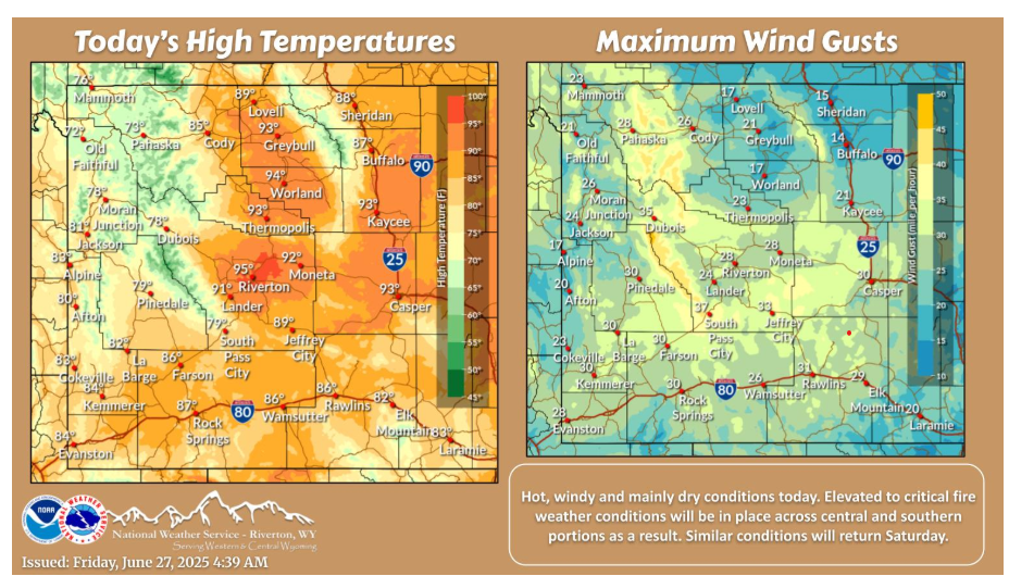
Elevated to critical fire weather conditions will be in place today, with hot temperatures, dry conditions and gusty winds. A Red Flag Warning is in effect across portions of Natrona County this afternoon.
Let’s have a fantastic day!