
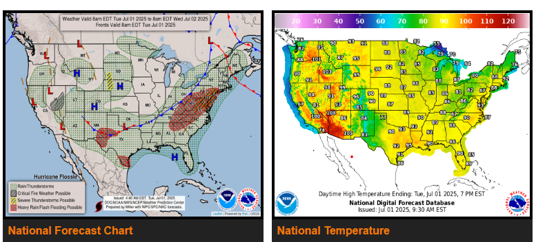
There is a Moderate Risk of excessive rainfall over parts of the Mid-Atlantic Today.
There is a Slight Risk of excessive rainfall over parts of the Southern High Plains and Western Gulf Coast on Tuesday and southern Mid-Atlantic, on Wednesday.
Today, a front extending from the Great Lakes/Ohio Valley to the Central/Southern Plains will move eastward to the East Coast by Wednesday evening. Showers and severe thunderstorms will develop along and ahead of the boundary over parts of the Mid-Atlantic.
Moisture from the Gulf will stream into southern Texas, creating heavy rain. Therefore, the WPC has issued a Slight Risk (level 2/4) of excessive rainfall over parts of southern Texas/Western Gulf Coast through Wednesday morning.
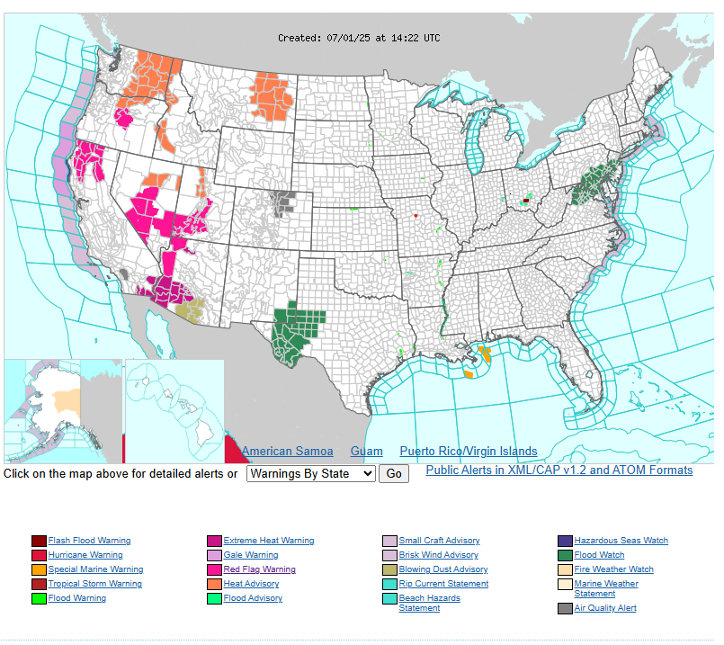
Hot temperatures this afternoon with some isolated thunderstorms across much of the area. Damaging winds are possible with some of the stronger storms across northwestern Wyoming to include Yellowstone this afternoon. Hot again tomorrow with a wider spread of storm activity.
NEBRASKA
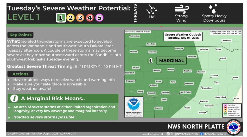
Isolated thunderstorms are expected to develop across the Panhandle and southwest South Dakota later this afternoon. A couple of these storms may become severe as they move southeastward across the Sandhills into southwest Nebraska this evening.
Let’s have a good and safe day!
"A good plan violently executed now is better than a perfect plan executed next week". - George S. Patton