
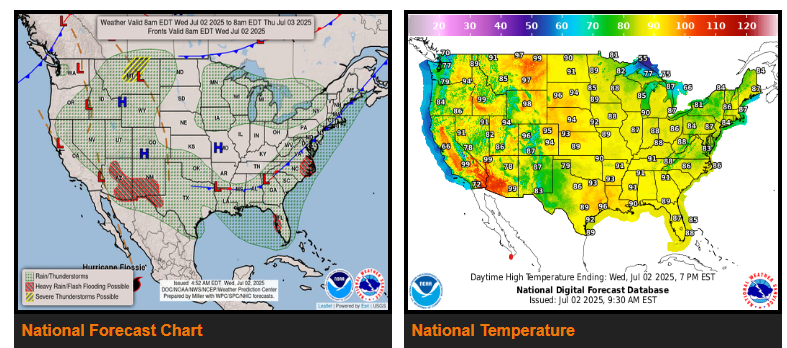
There is a Slight Risk of excessive rainfall over parts of the Southern High Plains/Southern Rockies/Southwest and southern Mid-Atlantic as well as Eastern Gulf Coast, on Wednesday and Eastern Gulf Coast on Thursday.
Showers and thunderstorms will develop along the boundary from the southern Mid-Atlantic to the Southeast/Eastern Gulf Coast and will produce heavy rain over parts of the southern Mid-Atlantic and Eastern Gulf Coast.
On Thursday, showers and thunderstorms with heavy rain will develop over parts of Florida.
Meanwhile, a front moving over the Pacific Northwest on Wednesday advances to the Northern High Plains/Northern Rockies and into the Great Basin by Friday. On Wednesday, the boundary will produce showers and strong to severe thunderstorms over parts of the Northern High Plains/Northern Rockies/Northern Intermountain Region.
Additionally, on Wednesday, an upper-level low along the Central/Southern California Coast will produce scattered showers and strong to severe thunderstorms over parts of the Great Basin. Furthermore, upper-level energy over the Southern Rockies with moisture streaming northwestward over the Southern High Plains/Southern Rockies and Southwest will produce showers and thunderstorms with heavy rain over the area.
WYOMING
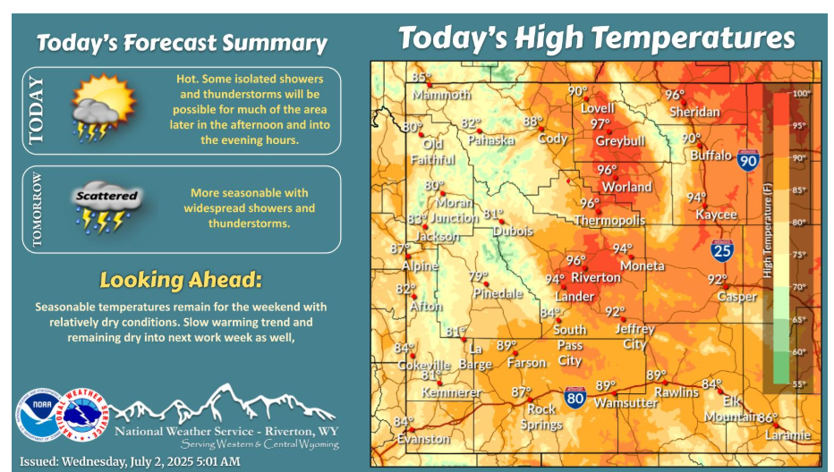
Hot temperatures once again this afternoon with breezy winds expected throughout. Better chances for thunderstorm coverage in the afternoon and evening becoming widely scattered, with strong outflow winds the main hazard and especially northwest into Yellowstone once again.
Have a fantastic day!
“Start where you are. Use what you have. Do what you can.” – Arthur Ashe