
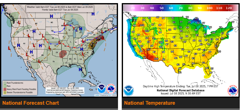
Scattered thunderstorms across the Arklatex region and across the Midwest later today.
Heavy rain and strong thunderstorms possible across the Mid-Atlantic later on Wednesday, and across the northern Plains into early on Thursday.
Major heat risks across much of the East today; triple-digit heat across the interior Northwest to northern High Plains as well as the Desert Southwest.
Tonight into early Wednesday will once again see the thunderstorms largely taper off. But during the day on Wednesday, more scattered thunderstorms will pop up farther east across the Deep South and into the southern Appalachians.
Temperature-wise across the CONUS, much above average temperatures area expected into Wednesday from the Southwest, across the Great Basin, Rockies and into the northern to central High Plains. Excessive heat watches and warnings are currently in effect across southeast California, southern and western Arizona and far southern Nevada where high temperatures over the next few days are expected to eclipse 110 degrees.
NEBRASKA
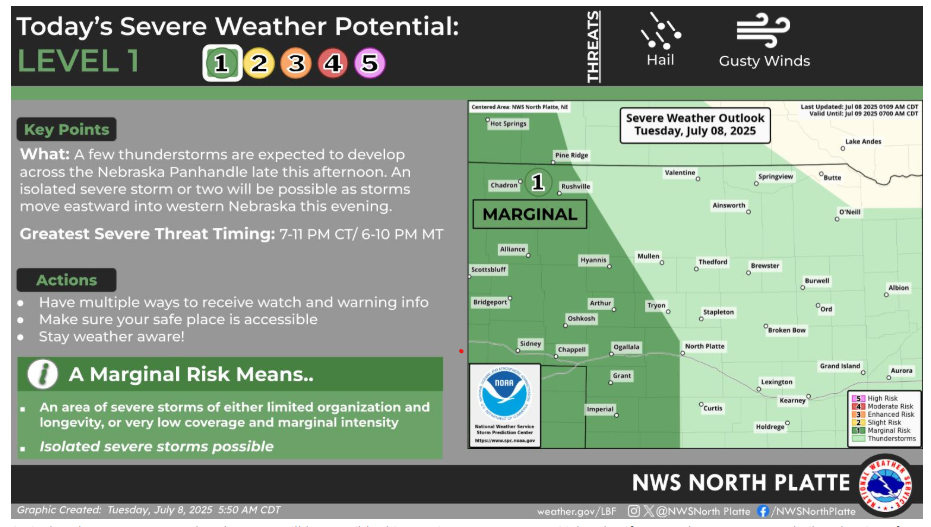
An isolated strong or severe thunderstorm will be possible this evening across western Nebraska. If a storm becomes severe hail to the size of a quarter and wind gusts up to 60 mph would be the main concerns.
Have a fantastic day!
“What you get by achieving your goals is not as important as what you become by achieving your goals”.
– Zig Ziglar