
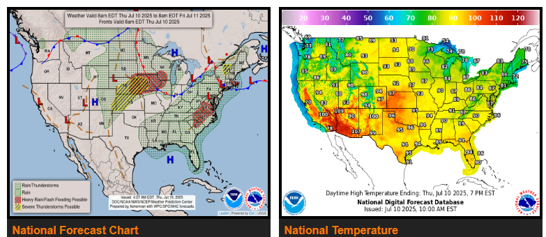
Multiple rounds of strong to severe thunderstorms are expected to impact the Northern and Central Plains into the Upper Midwest with excessive rainfall threats through the next couple of days.
Scattered late-day thunderstorms linger along the East Coast.
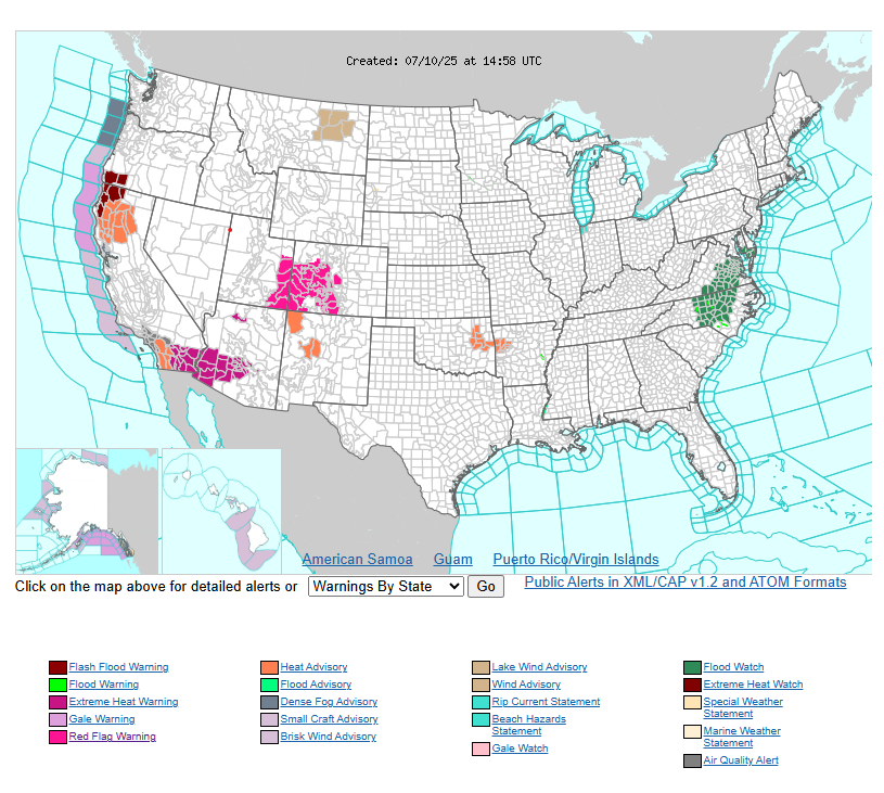
Major to locally extreme heat risk across portions of the Southwest for today.
A summer weather pattern with upper-level disturbances ejecting from the northern Rockies will support multiple rounds of strong to severe thunderstorms across many locations in the northern and central parts of the Great Plains through the next couple of days, as the disturbances interact with a lifting warm front and a lee-side trough.
thunderstorms are triggered during the afternoon today over the northern Plains where the severe weather threat is greatest, before traveling east into the upper Midwest where the excessive rainfall threat is greatest.
Along the East Coast, scattered late-day thunderstorms are expected each day as a lee-side trough remains in place across the interior Mid-Atlantic.
WYOMING
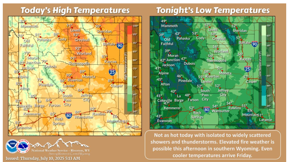
Somewhat cooler today with a mix of clouds and sun. A few showers and thunderstorms will be scattered about. Even cooler temperatures for Friday before a warm up begins this weekend.
NEBRASKA
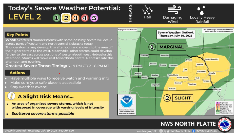
Scattered thunderstorms, a few possibly severe will be possible today across western and north central Nebraska.
Have a fantastic day!
“Perseverance is not a long race; it is many short races one after the other.” – Walter Elliot