
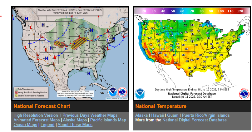
Widespread storms with the risk of flash flooding and severe weather expected in the Midwest the next couple of days.
Risk of flash flooding returns to the Southern Plains Saturday including portions of central Texas.
Heat builds in the western U.S. while the Interior Northeast and Southeast will also see an uncomfortably hot start to the weekend.
A slow moving cold front passing through the Midwest will bring widespread thunderstorms and the risk of both flash flooding and severe weather over the next couple of days. On Friday, storms are expected along and ahead of the boundary from the Upper Midwest/Great Lakes southwest through the Missouri Valley.
The heat will continue to build across the western U.S. heading into the weekend as an upper-level ridge expands overhead. Most locations will be into the 90s to low 100s, and into the low 110s in the Desert Southwest.
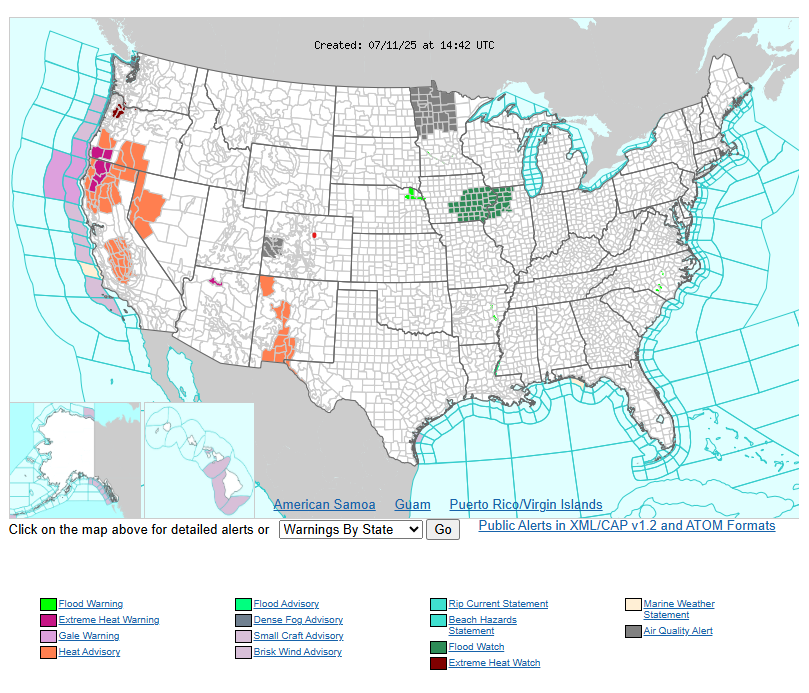
The most hazardous heat is expected across portions of New Mexico Friday, and then much of the central California Valleys into the western Great Basin by Saturday, with areas of Major Heat Risk expected, indicating a level of heat dangerous to anyone without access to adequate air conditioning or hydration.
WYOMING
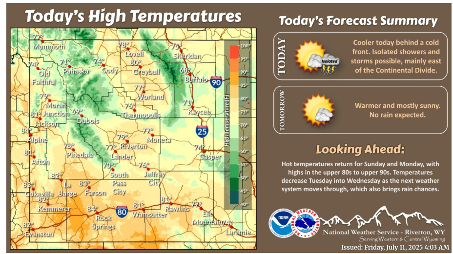
Cooler today behind a cold front. Isolated showers and thunderstorms will be possible today, mainly along and east of the Divide. Temperatures increase again through the weekend.
Have a fantastic day!
“A creative man is motivated by the desire to achieve, not by the desire to beat others”. – Ayn Rand