
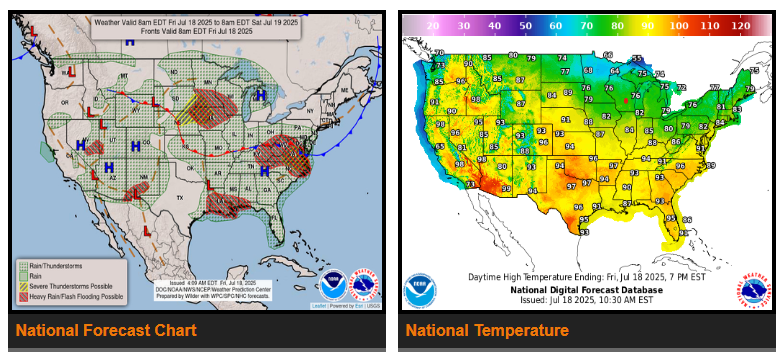
The front at the base of the Westerlies wavers around the Ohio Valley, the southern Great Lakes, the Southern Appalachians, and the Mid-Atlantic states over the next few days, providing the focus for thunderstorms with greater organization than typical for July which leads to both an enhanced flash flood risk and severe weather risk from the Midwest eastward and southeastward into this weekend.
Across portions of the Central Gulf Coast, the former tropical disturbance will march farther inland, enhancing flash flood concerns for the coastal plain between Houston and Pensacola on Friday. This system along with plentiful Gulf moisture is being pushed west and north by an anomalously strong subtropical ridge across the eastern Gulf Coast which drifts west each day.
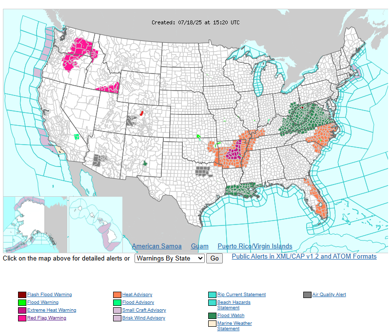
On the western periphery of the Gulf moisture, an active Monsoonal pattern continues for Arizona and portions of the Southern Rockies through Sunday, with scattered thunderstorms expected daily and a threat for isolated flash flooding, especially for terrain, sensitive areas from recent rains, and recent burn scars. Across the interior Northwest, it starts out hot on Friday ahead of an incoming cold front. Breezy conditions along with dryness has led to the posting of Red Flag Warnings in and near the Columbia Basin and portions of southern Idaho. The front’s passage cools off the Columbia Basin noticeably by Saturday, though heat remains across the remainder of the Intermountain West through at least Sunday.
WYOMING
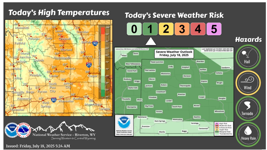
Showers and thunderstorms will be widespread across the forecast area this afternoon, starting over western portions and spreading eastward through the rest of the day. There is a Marginal risk some of these storms could be severe in the form of strong wind gusts up to 60 mph.
Have a fantastic day!
“The people who influence you are the people who believe in you.” – Henry Drummond