
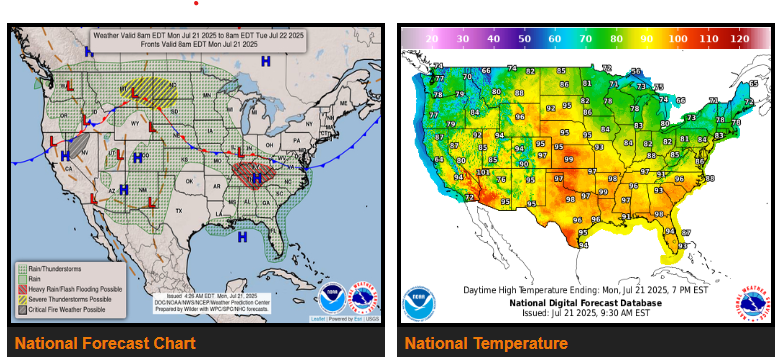
he “Dog Days of Summer” are in full swing for most of the eastern two-thirds of the Lower 48. This is brought about by a strengthening heat dome originating over the Deep South that builds in over the Mississippi and Ohio Valleys by mid-week. Expect some localized daily record highs to be broken in the Southeast, with an even larger swath of daily record warm minimum temperatures.
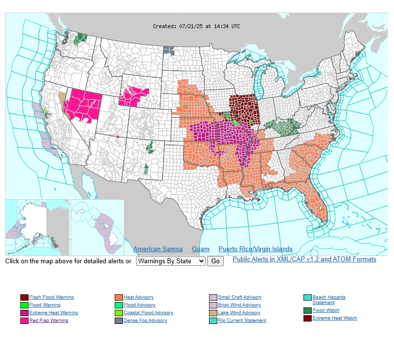
Heat indices from the Central Plains to the Southeast will range between 100-110F each day, with some locations reaching as high as 115F. For Monday, HeatRisk shows an expansive area of Major Impacts that are most common in the Southeast and Lower Mississippi Valley. By Tuesday, much of the Deep South on north through the Middle Mississippi Valley and into the Lower Missouri River Valley see Major Impacts according to HeatRisk.
Flash flooding in portions of the Ohio and Tennessee Valleys today, with a Slight Risk in place for parts of the Upper Midwest on Tuesday. There are Flood Watches in effect for parts of the Middle Mississippi and Ohio Valleys through this afternoon.
The Storm Prediction Center (SPC) has a Slight Risk (threat level 2/4) in place over eastern Montana today, then over parts of the eastern Dakotas and central Minnesota on Tuesday. Isolated severe storms are also possible in the Central Plains and Southeast each day. Damaging winds and large hail are the primary modes of severe weather, although the Northern Plains could also contend with some tornadoes.
WYOMING
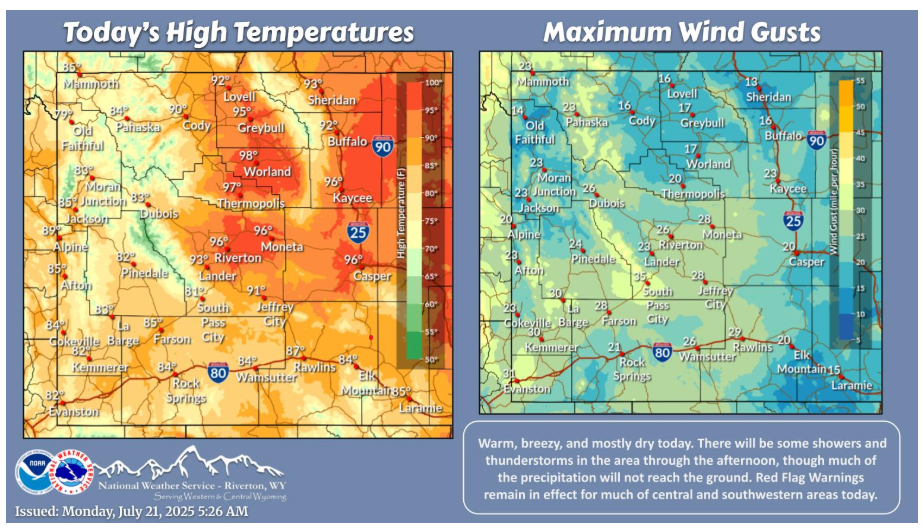
Warm, breezy, and mostly dry today. There will be some showers and thunderstorms in the area through the afternoon, though much of the precipitation will not reach the ground. Red Flag Warnings remain in effect for much of central and southwestern areas today.
Let’s have a fantastic day.
“From my tribe I take nothing, I am the maker of my own fortune.” – Tecumseh