
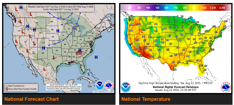
A stalled front from the Midwest to the southern Plains will weaken, but upper-level disturbances may still trigger scattered, less intense thunderstorms today and Wednesday. Storm chances will shift east toward the Deep South, Gulf Coast, and into the Appalachians and Mid-Atlantic. A cold front moving through the Great Lakes will spark storms in New England Wednesday evening, followed by drier air Thursday.
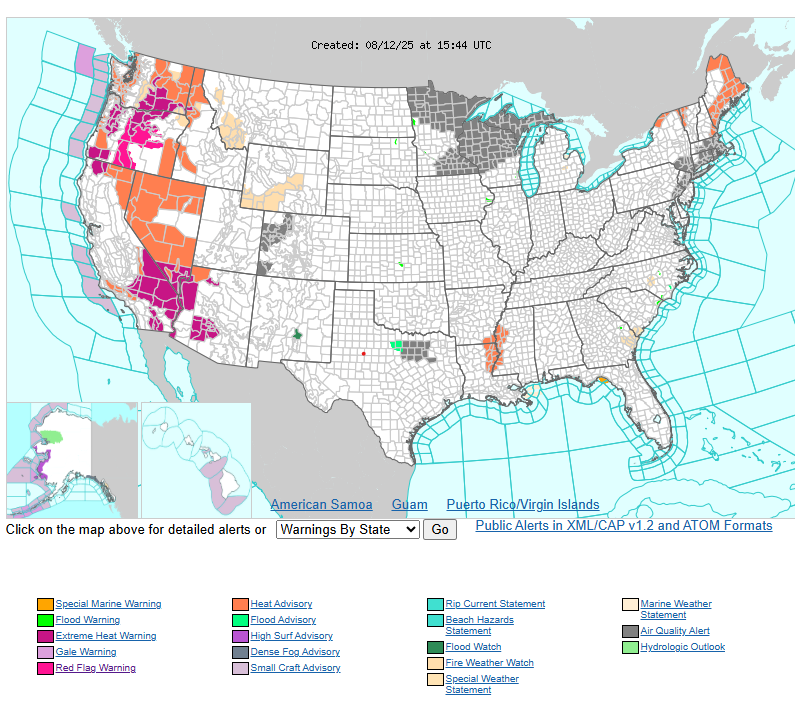
Cooler air will reach the northern Plains to Great Lakes, but heat and humidity will persist from the Ohio Valley to the Northeast, with some areas in the 90s. Clouds and rain will keep the South slightly cooler but muggy. In the West, high pressure will keep temperatures much above normal, with parts of the Southwest reaching 110–120°F under widespread heat alerts. Relief is expected in the Northwest late week as a cold front breaks the heat.
By Wednesday night into Thursday, a developing low over the northern Rockies will spread heat into the central High Plains and bring strong to severe storms to the northern Plains.
WYOMING
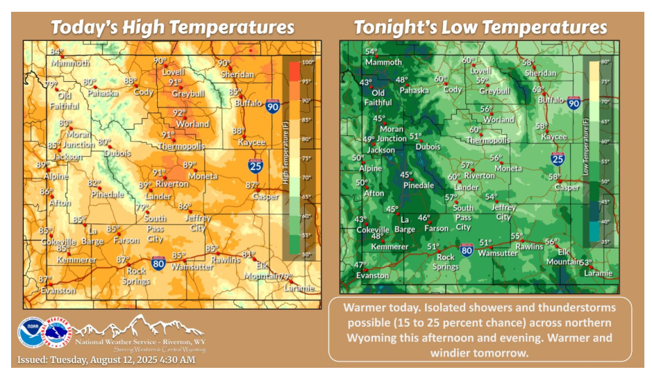
Temperatures trend warmer again today. There is a chance (15%-25%) for isolated showers and storms across northern Wyoming this afternoon and evening.
Have a fantastic day!