
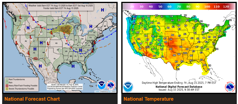
The NHC is tracking a tropical disturbance in the SW Gulf that could bring moderate to heavy rain to South Texas through Saturday before moving inland over NE Mexico or South Texas.
A slow-moving front will bring scattered showers and severe storms to the northern Plains and Upper Midwest through the weekend, with risks of damaging winds, hail, brief tornadoes, and flash flooding. Storms may continue overnight and into Saturday and Sunday, spreading into the Northeast by Sunday.
Daily storms are likely across the South and Southeast, with increased rain in the Pacific Northwest moving into the northern Rockies, Great Basin, and northern California by Sunday. Monsoon moisture will keep storms in the Four Corners region, with isolated flash flooding possible.
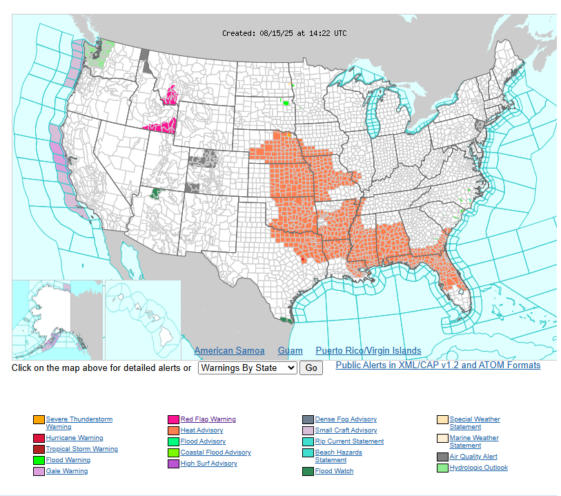
The West Coast stays cooler than average, while much of the Central and Eastern U.S. sees above-average heat. The Central Plains to Midwest may reach the mid-to-upper 90s and low 100s, with dangerous heat index values and Major to Extreme Heat Risk.
Have a fantastic day!