
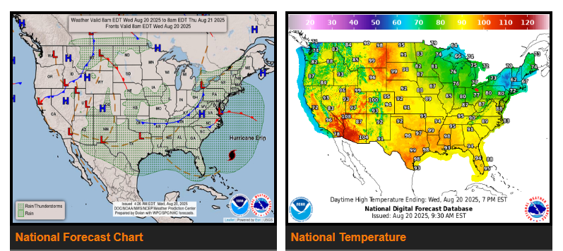
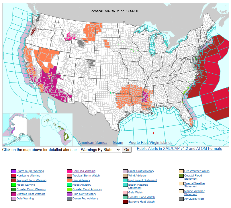
Hurricane Erin is northeast of the Bahamas and expected to track north then northeast, staying offshore but impacting the East Coast. The Outer Banks will see tropical storm conditions late Wednesday with strong winds, heavy rain, storm surge (2–4 ft), and dangerous surf. Virginia is under a Tropical Storm Watch with 1–3 ft surge possible. Impacts may extend into the Mid-Atlantic and southern New England Thursday–Friday. Rip currents and rough surf will affect much of the East Coast — beachgoers should use caution.
Scattered thunderstorms are forecast across the East and South-Central U.S. this week, bringing heavy downpours and isolated flash flooding, especially near the Appalachians, Gulf Coast, and southern New England. The Southwest and Upper Midwest may also see storms with localized flooding.
Dangerous heat will intensify across the Southwest, with highs in the 100s–110s and heat advisories in effect. The Pacific Northwest will warm after a cooler start, while parts of the Plains and Lower Mississippi Valley face hot, muggy conditions with heat indices up to 110°. Cooler weather continues across the Northeast with highs in the 60s–70s.
WYOMING
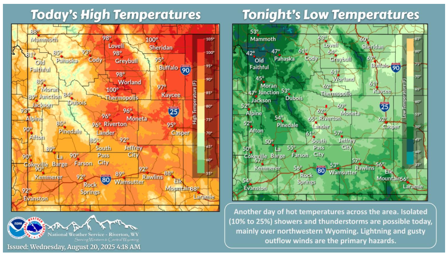
After breaking some high temperature records yesterday, today brings another day of heat. Isolated (10%-25%) showers and thunderstorms occur over northwest Wyoming this afternoon and evening, with lightning and gusty winds the main hazards. Cooler temperatures expected to end this week.
Have a fantastic day.