
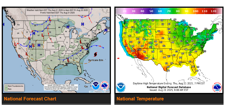
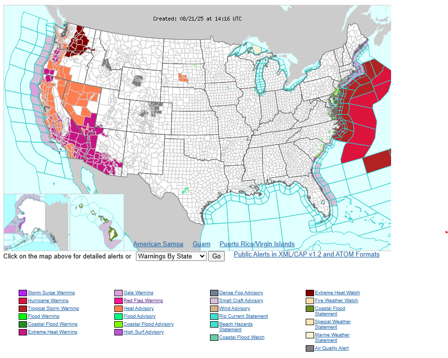
Hurricane Erin continues to churn offshore, bringing tropical storm conditions to the NC Outer Banks and spreading north to Virginia Thursday. Strong winds may reach the Mid-Atlantic and southern New England into early Friday. Storm surge, large waves, and dangerous rip currents will cause beach erosion, overwash, and road impacts along the coast.
Thunderstorms & Flooding: A slow-moving front will bring heavy rain and flash flooding risks from the southern Appalachians to the Gulf Coast and into Texas. Central/southern Georgia and coastal South Carolina face a higher risk of flooding. Storms will also affect the Southwest, Rockies, Upper Midwest, and northern High Plains with locally heavy downpours.
Heat: Extreme heat will intensify across the western U.S., with widespread warnings in California, Oregon, Nevada, and the Desert Southwest (90s–110s). Northern/Central Plains remain hot Thursday before cooler air arrives Friday. The Northeast stays cooler in the 70s Thursday before warming into the 80s Friday.
Have a fantastic day.