
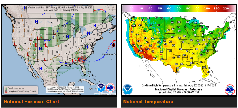
A stationary front along the Gulf and Southeast Coasts will trigger showers and thunderstorms this weekend. The combination of instability, moisture, and the frontal boundary will lead to heavy rainfall, especially across southern Georgia into southern South Carolina today. A high-end slight risk (about a 25% chance) of excessive rainfall and flash flooding is in effect for these areas. On Saturday, the Central and Southern Appalachians may also see isolated flash flooding as a cold front and upper trough move in from the west.
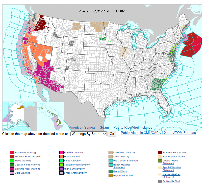
Meanwhile, an upper-level ridge over the West will continue to fuel monsoonal storms across the Desert Southwest, the Four Corners, and into the Central and Southern Plains. At the same time, a dangerous heat wave will expand across much of the Western U.S. through the weekend. The most extreme and long-lasting heat is expected from the Desert Southwest into California’s San Joaquin Valley, where Excessive Heat Warnings and Watches are in effect from Arizona through Washington.
Numerous daily high-temperature records are possible, with little relief at night as overnight lows stay well above normal. This lack of cooling increases the risk of heat-related illness, especially for those without air conditioning or access to effective cooling.
WYOMING
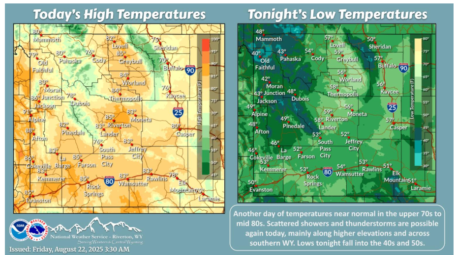
Temperatures near normal today in the upper 70s to mid 80s. Scattered showers and thunderstorms are expected this afternoon, mainly along higher elevations and across southern WY. Mian threat with any thunderstorms would be gusty winds. Low temperatures tonight fall into the 40s and 50s.
NEBRASKA
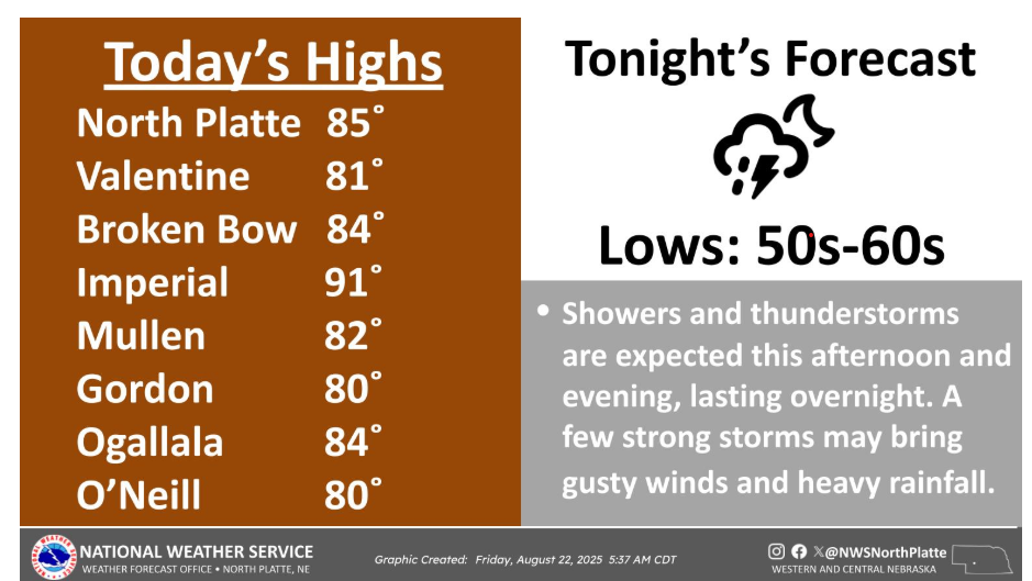
Showers and thunderstorms are expected this afternoon and evening, with storms lasting overnight. Highs climb into the 80s, with a few locations in southwest Nebraska breaking into the low 90s.
Have a fantastic day.