
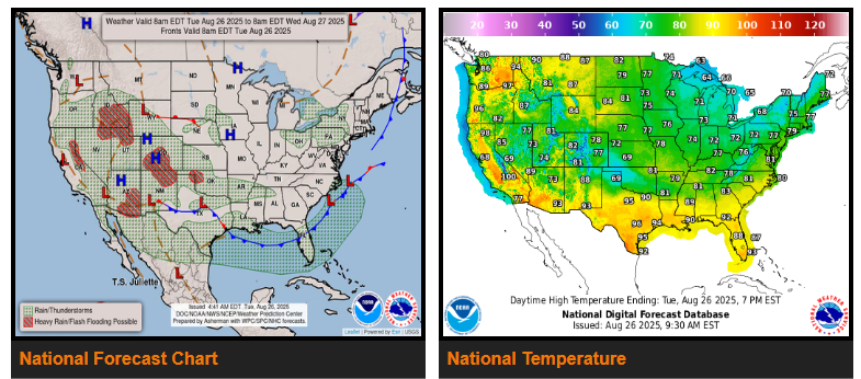
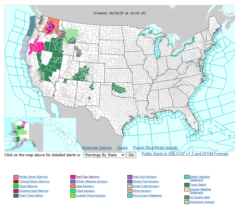
Through Thursday, the West will see showers and thunderstorms fueled by monsoonal moisture and upper-level disturbances, bringing flash flood risks to the Southwest, Idaho, and northern Utah. Flooding may impact dry washes, urban areas, burn scars, and canyons, with storms most active in the late afternoon and evening. A slow-moving upper trough will spread storms across the northern Great Basin and Rockies, while a Northwest heat wave continues today with highs near 100°F and little nighttime relief before easing on Wednesday.
Across the Plains and Mid-South, heavy rainfall north of a front could bring flash flooding to Colorado, New Mexico, Oklahoma, Kansas, and surrounding areas. Rainfall rates up to 2.5″ per hour may cause urban flooding, and saturated soils will heighten risks. Cooler highs in the 60s and 70s may set record cold daytime temperatures in Kansas, Oklahoma, Arkansas, and nearby states.
East of the Rockies, strong high pressure will keep temperatures well below normal, feeling more like early fall than late summer. Morning lows in the 40s and 50s may break records from the Midwest through the Tennessee and Ohio Valleys, Appalachians, and Gulf Coast. Sunshine will dominate much of the Midwest, Appalachians, and East through midweek, while lake-effect showers and storms develop near the Great Lakes later Wednesday into Thursday.
WYOMING
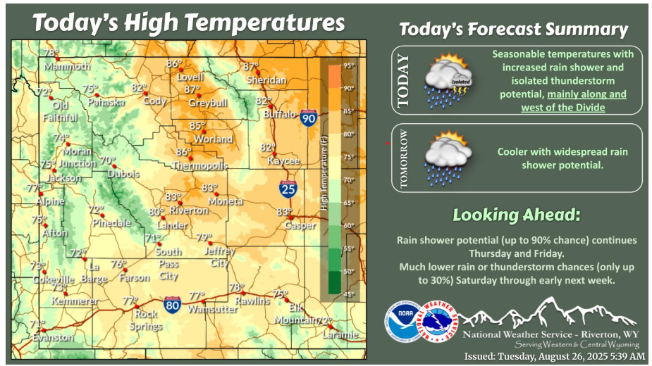
Showers and isolated thunderstorms are forecast today, mainly along and west of the Divide. Rain showers are forecast to push east of the Divide tonight into Wednesday morning with more widespread rain chances.
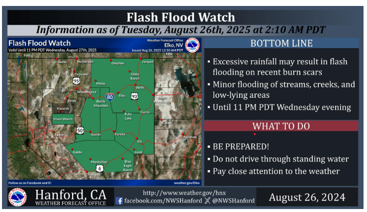
A Flash Flood Watch is in effect for most of Northern and Central Nevada until 11 PM PDT Wednesday evening. The majority of rain will fall this afternoon and this evening. Excessive rainfall may cause flash flooding on recent burn scars. Heavy rainfall could result in minor flooding of streams, creeks, and low-lying areas. Never drive through water of unknown depth.
Have a fantastic day.