
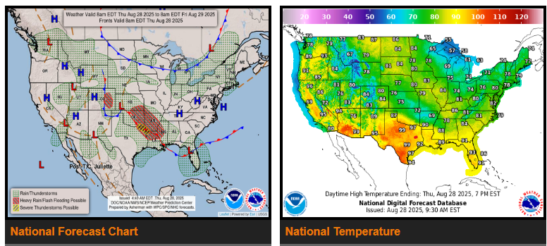
The Southwest’s active weather is winding down as monsoon moisture shifts into the Rockies and High Plains, bringing widespread showers and thunderstorms. Parts of Colorado’s Front Range and High Plains face a higher risk of flash flooding, especially in burn scar areas.
Moisture from weakening Tropical Storm Juliette may reach Southern California and later the southern High Plains by Friday, combining with Gulf moisture to fuel heavy thunderstorms and potential flash flooding.
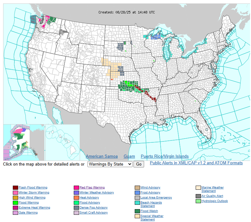
Farther east, a stationary front will trigger storms from Kansas and Oklahoma into the Lower Mississippi Valley, with the heaviest rain expected Friday over northern Louisiana and southern Mississippi. Some areas could see 2–4 inches of rain. Flood watches are already in effect across portions of Kansas, Missouri, Oklahoma, and Arkansas.
In the Great Lakes and Northeast, a passing cold front will bring rain showers and usher in a much cooler air mass heading into Labor Day weekend. Temperatures across the central Plains, Ohio Valley, and Mid-Atlantic may run 10–15 degrees below normal, with some record lows possible.
Meanwhile, the Pacific Northwest warms back up into the 80s and 90s, while southern and western Texas could climb into triple digits.
WYOMING
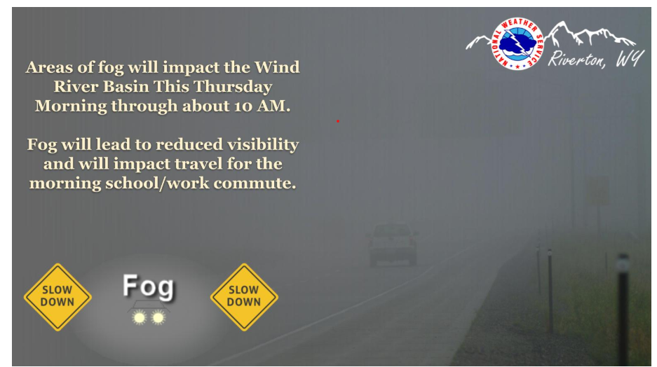
Areas of fog on your morning commutes across portions of the Wind River Basin. Expect this to lift by 10AM mid Thursday morning, drive safe!
Have a fantastic day.