
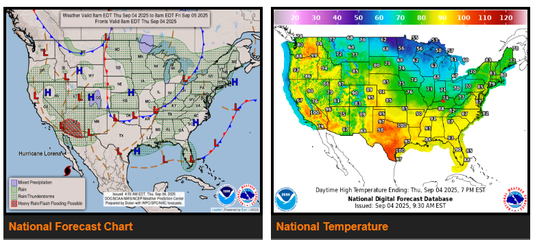
A strong cold front will push into the Appalachians, Mid-Atlantic, and interior Northeast today, bringing scattered showers and storms, a few potentially strong with damaging winds. The front weakens by the weekend but keeps showers around.
Another powerful cold front will move from the northern Plains into the central U.S. Friday, then reach the southern Plains, Ohio/Tennessee Valleys, and Northeast by Saturday. Ahead of it, summer-like heat builds with 80s–90s common, and triple digits in southern Texas. A sharp cool down follows with highs only in the 50s–70s, about 15–25° below normal.
South Florida stays unsettled with slow-moving storms capable of heavy rain and localized flash flooding through Friday.
Across the Southwest and Four Corners, daily storms continue with flash flooding possible, especially in Arizona as moisture from Hurricane Lorena lifts north.
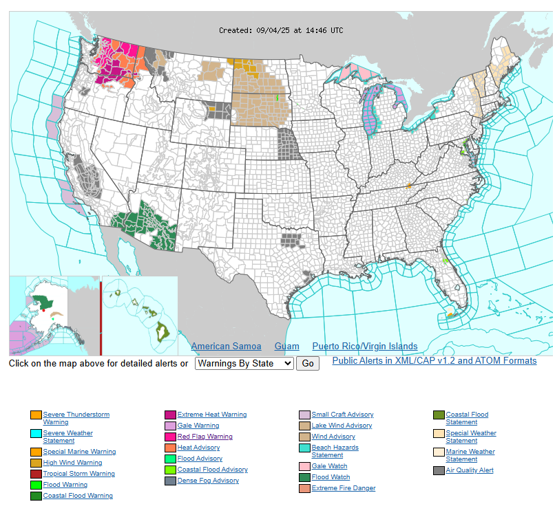
In the Pacific Northwest, dangerous heat continues today with highs in the 90s–100s and heat advisories in place. Relief arrives this weekend as temperatures ease.
WYOMING
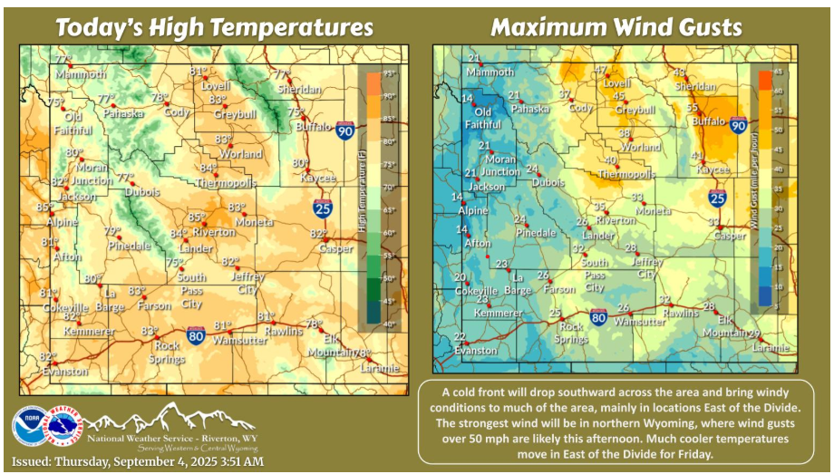
A cold front will bring windy conditions to many areas this afternoon, especially East of the Divide. The strongest wind will be in northern Johnson County, where gusts over 50 mph are likely.
Have a fantastic day.