
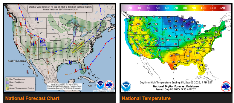
A front stretching from the Great Lakes to the Southern Plains will move east through Sunday, reaching the Northeast, Mid-Atlantic, Southeast, and Gulf Coast. Showers and severe thunderstorms are expected along and ahead of the boundary, especially across the Ohio and Tennessee Valleys, where SPC has issued a Slight Risk (level 2/5) for severe storms. Hazards include damaging winds, hail, frequent lightning, and isolated tornadoes.
By Saturday, strong storms will spread into the Northeast and Mid-Atlantic, with additional showers and storms across the Lower Mississippi Valley, Southern Plains, and Florida.
Monsoonal moisture will continue to bring thunderstorms to Southern California, the Southwest, Great Basin, and Rockies, expanding into the Interior Northwest by Saturday.
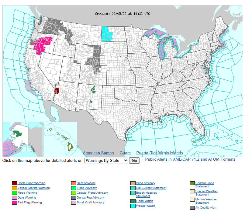
Smoke from wildfires is causing Air Quality Alerts across parts of the Northwest and Northern/Central High Plains.
WYOMING
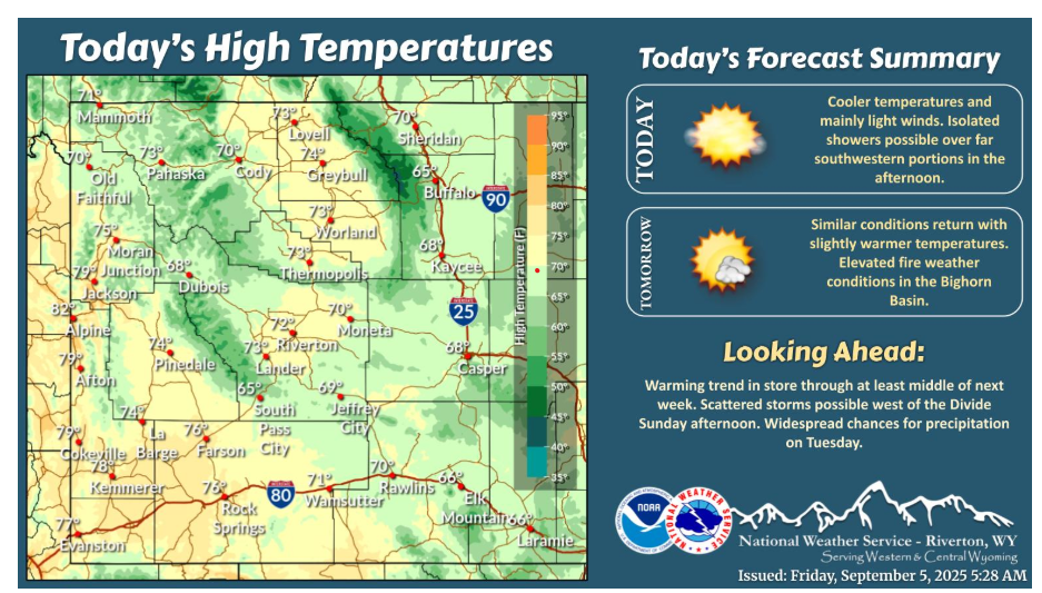
Dry and cooler conditions today. Isolated showers and a few lightning strikes will be possible over far southwestern portions in the afternoon. Similar conditions return Saturday, with slightly warmer temperatures returning to near seasonal levels.
Have a fantastic day and weekend.