
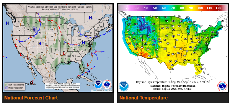
Showers and storms across the Great Plains are weakening today, leaving only isolated activity across the central U.S. Low pressure over the northern Plains will keep showers and storms going through today before shifting into the Upper Midwest and fading.
Along the East Coast, a coastal storm off the Southeast will strengthen and move toward North Carolina tonight, bringing heavy rain and gusty winds into North Carolina and Virginia on Tuesday. Rain is expected to spread into the Mid-Atlantic and possibly southern New England by Wednesday.
In the Pacific Northwest, a cold front brings cooler temperatures today along with scattered showers and storms across the northern Rockies and into the High Plains. By Tuesday night, stronger storms may develop over the north-central Plains.
Temperatures will stay hot across the Midwest and Mississippi Valley, with highs in the mid-80s to mid-90s and some areas near record heat. The East will also remain unseasonably warm, while the Mid-Atlantic coast trends cooler with clouds and rain. The Southwest will see more seasonal temperatures, and the Northwest warms again after a brief cooldown today.
WYOMING
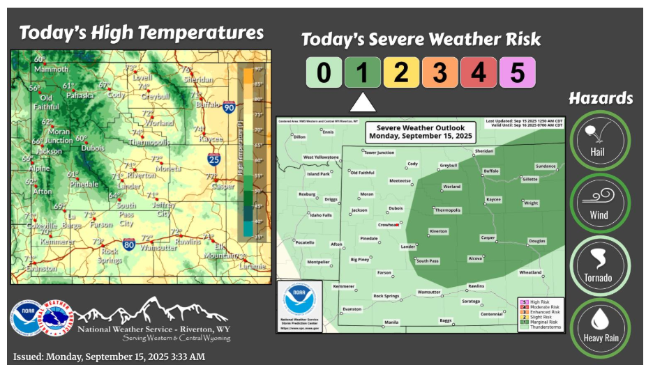
A weather system will bring scattered showers and thunderstorms today. A few could become strong to severe, with strong wind gusts and small hail the main threat. More showers and storms are possible on Tuesday.
Have a fantastic day.