
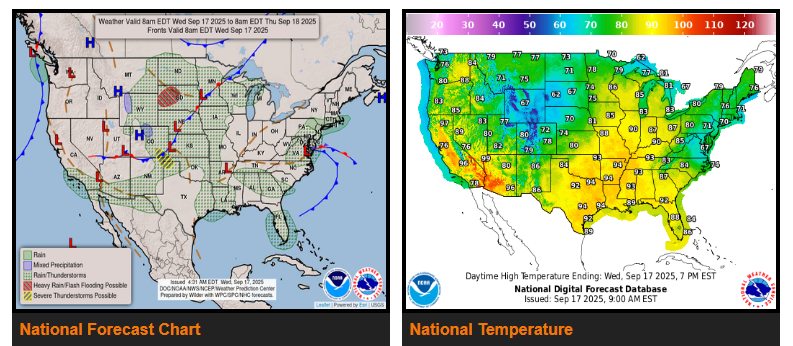
A coastal storm, similar to a cold-season nor’easter, made landfall this morning in eastern Virginia and will weaken today while spreading rain across the Mid-Atlantic, with some showers reaching southeastern New England before clearing by Thursday. Meanwhile, unsettled weather in the northern and central Plains will bring heavy rain and severe thunderstorms, with 1–2 inches possible in western South Dakota before conditions ease late Thursday. Moisture from post-tropical Mario will reach Southern California today, spreading north into Thursday and bringing much-needed rainfall to California, Arizona, and New Mexico. Temperatures will run above normal across much of the central U.S., with highs in the 90s across the Midwest, while cooler-than-normal conditions persist along the East Coast and northern Rockies. In Florida, tropical moisture from the western Caribbean will fuel showers and thunderstorms, with the Keys seeing up to 3 inches of rain by Friday.
WYOMING
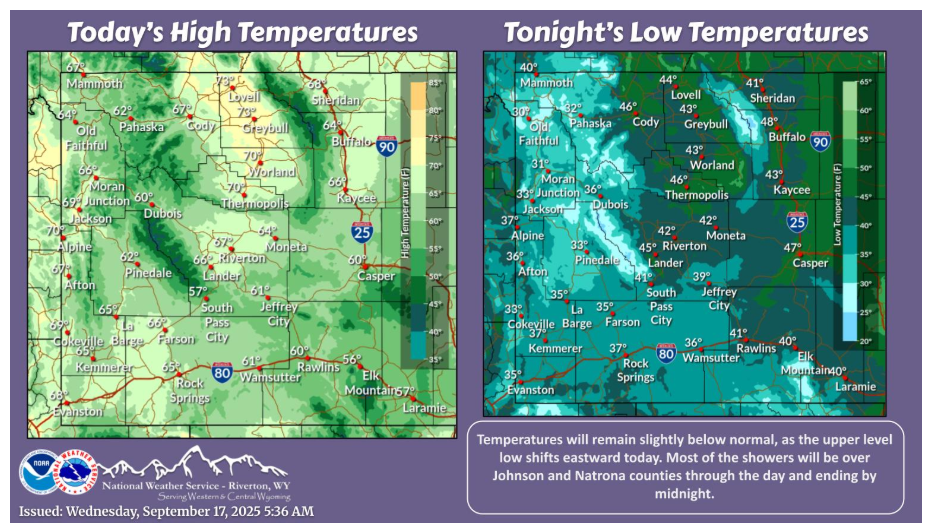
Showers cont’ across portions of Natrona Co. this morning, becoming more widespread into Johnson Co. this afternoon. Overcast skies this morning will gradually scatter out this afternoon, with clear skies late tonight. Temperatures will remain slightly below normal today.
Have a fantastic day.