
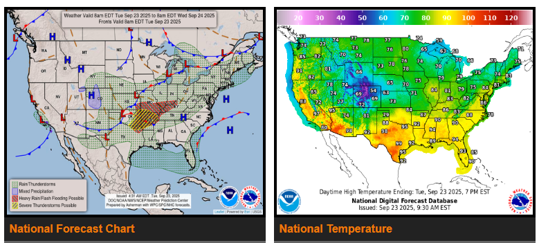
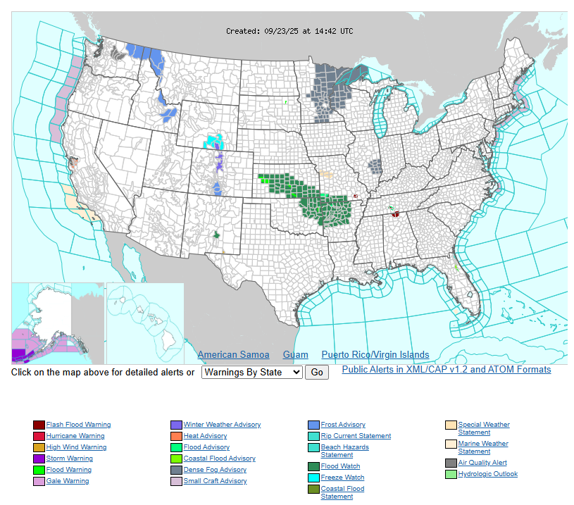
An active and unsettled pattern continues across the central U.S. over the next couple of days, bringing risks of flash flooding and severe storms. Heavy rain and thunderstorms are likely Tuesday from the Great Lakes through the Mississippi Valley into the central and southern Plains, with the greatest threat across the Lower Ohio Valley, Mid-South, Ozarks, and ArkLaTex. These areas face a risk of flash flooding, large hail, damaging winds, and a few tornadoes.
By Wednesday, the system shifts east, spreading storms across the Ohio, Tennessee, and Mississippi Valleys down to Texas and the Gulf Coast. Flash flooding remains possible, especially in areas with recent heavy rain.
Elsewhere, showers and thunderstorms will impact the Northeast and Florida Peninsula, while scattered storms linger in the Rockies, west Texas, and New Mexico. California may see heavy rain and isolated flash flooding, especially near burn scars.
Temperatures will be above normal in much of the country, especially across the northern tier, with highs in the 70s–90s. The Desert Southwest will be hottest, reaching the 100s. Cooler air behind the front will drop highs into the 50s–60s across the Rockies and Plains, spreading east and south by midweek.
WYOMING
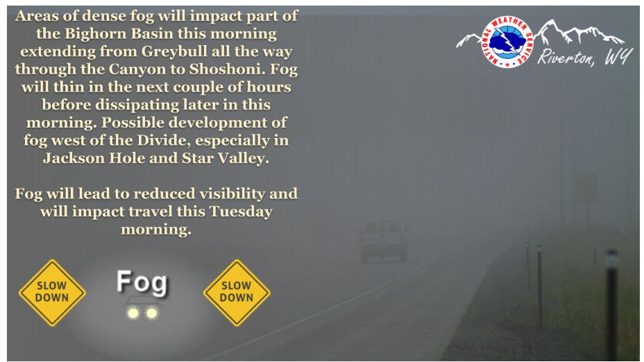
Areas of patchy dense fog observed across portions of the Bighorn Basin extending south to Shoshoni. Additional areas of development possible west of the Divide in the next hour or so before all lifting later this morning with daytime heating.
Some lingering rain showers early this morning but quickly improving skies giving way to a warmer afternoon under ample sunshine and light winds.
NEBRASKA
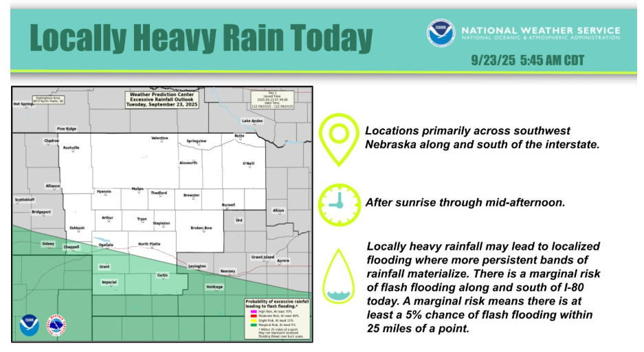
As an upper level low pressure system crosses the area today. Locally heavy rainfall could develop, primarily across southwest Nebraska, along and south of Interstate 80.
Have a fantastic day!