
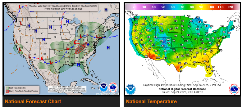
Widespread thunderstorms will continue over the next couple of days as a strong cold front pushes from the central U.S. toward the East Coast. On Wednesday, storms are expected from the Northeast and Great Lakes southwest through the Appalachians, Ohio and Tennessee Valleys, Mississippi Valley, and into the southern Plains, with the heaviest rainfall and flash flooding risk centered in the Ohio and Tennessee Valleys. By Thursday, the storm focus will shift east, stretching from the Northeast down the East Coast, through the Appalachians and Southeast, and into southern Texas. While heavy rainfall is possible, flash flooding concerns will be more isolated, mainly across southern New England, the greater New York City area, and the southern Appalachians. Damaging wind gusts may also occur with these storms, and daily thunderstorms will continue across the Florida peninsula.
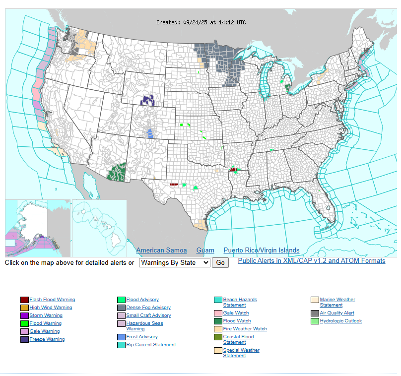
Out West, an upper system will bring storms along the central California Coast on Wednesday with an isolated flash flood threat. By Thursday, moist air moving north from Mexico will help fuel thunderstorms across the Southwest, Arizona, and New Mexico. Heavy rainfall could lead to flash flooding in terrain-sensitive areas, including burn scars and urban locations.
Temperatures across much of the country will remain above normal. Northern states will see highs in the 70s and 80s through Thursday, while the West will range from 70s and 80s in the Great Basin to 90s and even 100s in the Desert Southwest. Along the East Coast, highs will be in the 70s in the Northeast, 80s in the Mid-Atlantic, and 90s from the Carolinas south into Florida. Cooler air will follow behind the front across the central U.S., with highs mainly in the 70s on Wednesday before moderating Thursday. Meanwhile, the interior Northwest will remain hot, dry, and windy, leading to critical fire weather conditions.
Stay alert for changing conditions, especially in areas prone to flash flooding or strong winds.
Have a fantastic day.