
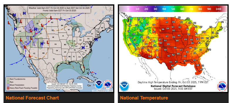
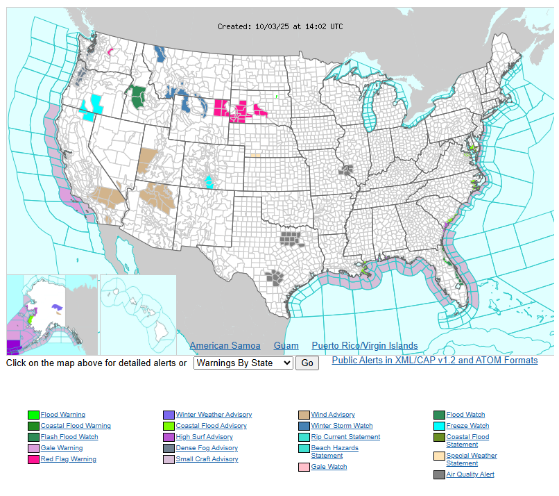
A strong weather pattern will set up across the U.S. this weekend. Cooler than normal temperatures, heavy rain, and mountain snow are expected from the West Coast through the Rockies, with Winter Storm Watches in effect for parts of the Northern Rockies where several inches of snow are possible. Meanwhile, record-breaking heat will continue Friday and Saturday from the Northern Plains into the Great Lakes, with highs in the mid 80s to low 90s, running 15 to 30 degrees above average. HeatRisk alerts are in place for the Dakotas, Minnesota, Iowa, Wisconsin, and northern Illinois, with relief arriving late this weekend as a strong cold front moves east.
Along the East Coast of Florida and into the Southeast, persistent onshore flow will bring showers and heavy rainfall through the weekend, raising the risk of localized flooding in urban areas. Some rain may also reach the central Gulf Coast, though heavier amounts will remain offshore. Across the Intermountain West and into the Plains, rain and thunderstorms will develop ahead of the cold front Friday and Saturday, with a risk for isolated severe weather including high winds and hail.
WYOMING
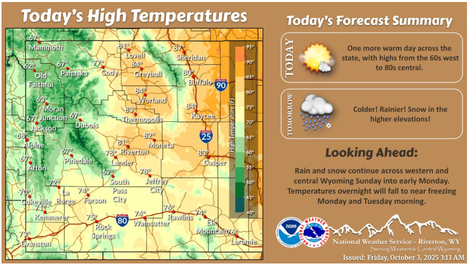
Don’t let today’s graphic fool you! We have one more day of warm temperatures today before a sudden temperature plunge Saturday, along with widespread rain and higher elevation snow through the weekend. Enjoy the mild temperatures today.
Are you heading into the mountains this weekend? A cold weather system will make its way into the region starting late Friday night and bring much colder temperatures, low elevation rain, and high elevation snow.
Have a fantastic day.