
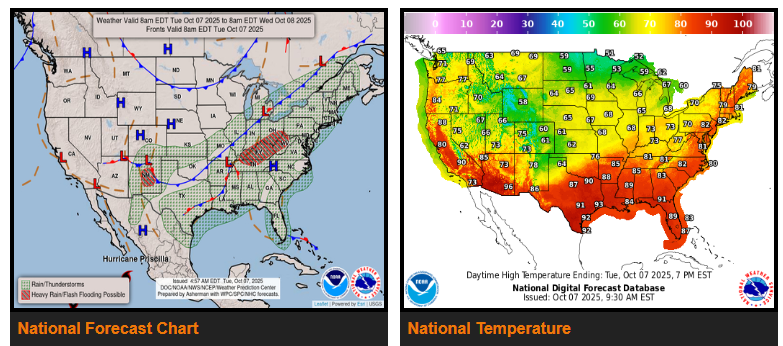
A slow-moving cold front will track across the east-central U.S. today and tonight, reaching the East Coast by Tuesday. Gulf moisture pooling along and ahead of the front will bring widespread rain and thunderstorms from the Great Lakes through the Ohio and Tennessee Valleys, the Appalachians, and into the Southeast. The heaviest rainfall of 2 to 4 inches is expected in parts of Kentucky, with a Slight Risk (level 2/4) for flash flooding across the Ohio Valley and central Appalachians through tonight. Rain will shift eastward overnight and into Wednesday morning, affecting the Northeast and Mid-Atlantic before tapering off by midday, though showers may linger in the Carolinas. A weak surface trough will also trigger scattered showers and storms across the Florida Peninsula over the next couple of days.
Out west, the trailing edge of the front will stall over the Southwest, bringing waves of low pressure and tropical Pacific moisture northward. This setup will lead to rain and thunderstorms across New Mexico, where a Slight Risk (level 2/4) of flash flooding is in effect today. Burn scar areas and urban zones will be especially prone to flooding. A Marginal Risk (level 1/5) for isolated severe storms with high winds and hail is also in place for central New Mexico. This marks the start of a multi-day stretch of unsettled weather across the Southwest as moisture from Hurricane Priscilla continues to stream north, with rainfall amounts varying day to day.
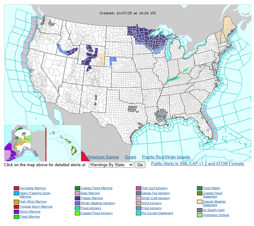
The front will separate warmer-than-normal air to the south and east from cooler air to the north and west. Above-normal temperatures continue today from the Gulf Coast to the Eastern Seaboard, with the Northeast running 10–20°F above normal and a few record highs possible. Temperatures will drop to near normal by Wednesday as the front passes. Behind it, cooler air has brought Freeze Warnings and Frost Advisories to parts of Minnesota and Wisconsin through Wednesday morning. Highs today will only reach the 60s as far south as the Oklahoma and Texas Panhandles—around 15–20°F below average. Conditions will gradually moderate midweek, with the Intermountain West warming under a building ridge, while a new Pacific front cools the Northwest and brings light precipitation, including possible high-elevation snow in the Cascades.
Have a fantastic day.