
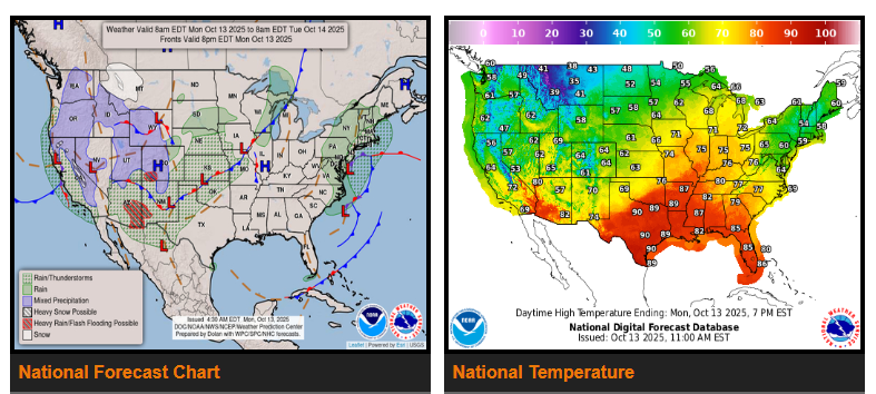
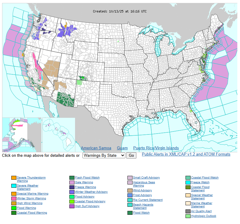
Early this week, a mix of rain, snow, and wind will impact several regions. On Monday, heavy rain and a Slight Risk of flash flooding are expected across parts of the Southwest and Central Rockies. The Northern Rockies could also see heavy snow, making for slick and potentially hazardous mountain passes.
By Tuesday, Southern California will experience periods of rain with a Slight Risk of flooding, especially in low-lying or recently burned areas. Heavy snow will continue across the Sierra Mountains, creating challenging travel conditions.
Along the East Coast, a coastal storm moving north on Monday will bring heavy rain, strong wind gusts up to 45 MPH, and potential coastal flooding from the Mid-Atlantic to New Jersey. Drivers in coastal areas should be alert for flooded roadways, downed power lines, and gusty conditions.
Overall, expect winter-like conditions in the mountains and wet, windy weather along the coasts. Please drive carefully, slow down in rain or snow, and watch for flooded or icy roads.
WYOMING
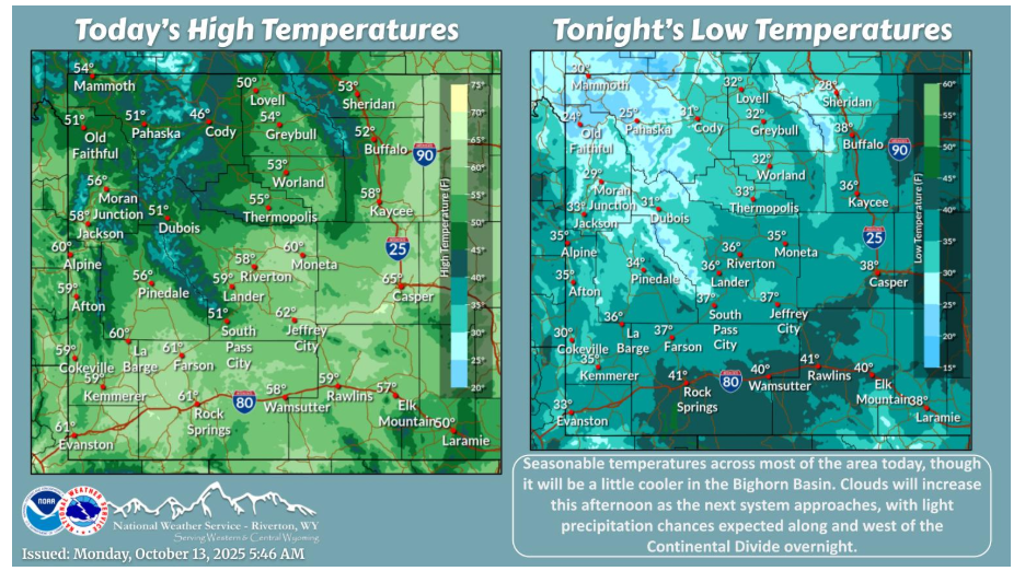
Seasonable temperatures across most of the area today, though it will be a little cooler in the Bighorn Basin. Clouds will increase this afternoon as the next system approaches, with light precipitation chances expected along and west of the Continental Divide overnight.
Have a fantastic day.