
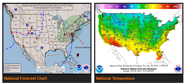
A strengthening storm system will bring widespread showers, thunderstorms, gusty winds, and a risk of coastal flooding to the Northeast on Thursday. A strong low-pressure system moving from the Ohio and Tennessee Valleys into the Northeast will cause moderate to heavy rainfall, especially across the Mid-Atlantic and New England. The northern Mid-Atlantic and greater New York City area could see heavier downpours and isolated flash flooding as moist air moves in from the Atlantic. The Storm Prediction Center has issued a Marginal Risk (1/5) for severe weather across the southern Mid-Atlantic, with the potential for isolated damaging winds or a brief tornado. Showers will continue into Friday, mainly across the Interior Northeast, before tapering off. Gusty winds and minor coastal flooding are possible as the system moves out.
Behind the cold front, cooler-than-average temperatures will spread from the Southeast through the central and southern Plains. Highs will range from the 50s and 60s, reaching only the 70s in south Texas and Florida. Morning lows Friday and Saturday will drop into the 30s and 40s, with patchy frost possible in parts of Texas, the Southeast, and even near the Gulf Coast. Temperatures will gradually moderate into Halloween weekend but remain slightly below average.
After a brief dry period, another Pacific storm system will arrive Friday, bringing heavy rain to the Pacific Northwest. Several inches are possible along the Olympics, Cascades, and coastal ranges, with snow levels remaining high. Localized flooding may occur near rivers and low-lying areas. In contrast, much of the western U.S. will stay warmer than average through the weekend, with highs in the 50s and 60s across the Northwest, 70s and 80s in central California, and 80s to 90s in southern California and the Desert Southwest.
A weak system will bring light showers to parts of the Plains and Upper Midwest, while lake-effect showers develop around the Great Lakes. By Saturday, thunderstorm chances may increase along the western Gulf Coast as moisture returns ahead of a developing front.
WYOMING
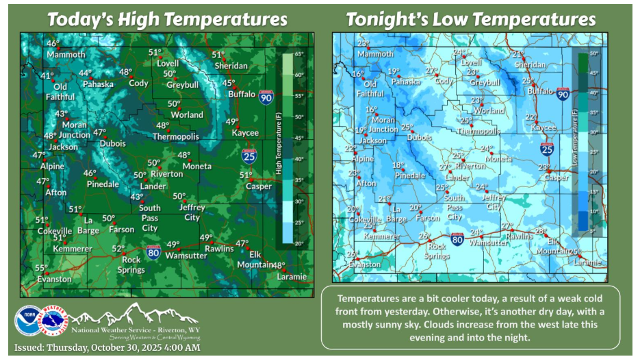
Temperatures are a bit cooler today, a result of a weak cold front from yesterday. Otherwise, it’s another dry day, with a mostly sunny sky. Clouds increase from the west late this evening and into the night.
Have a fantastic day.