
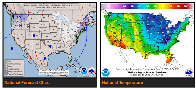
A blast of arctic air is bringing sharply colder temperatures across the eastern two-thirds of the U.S., with record-setting highs and lows expected across the Southeast—including all of Florida—through tonight.
Snowy, very cold, and windy conditions will persist from the Great Lakes to interior New England and along the west slopes of the Appalachians.
A strong upper-level low over the Ohio Valley and Upper Midwest is shifting northeast into Canada by Wednesday, sending a frigid continental polar airmass deep into the Central and Eastern U.S. Temperatures will run 20–30°F below average, likely breaking numerous records across the Southeast and Florida.
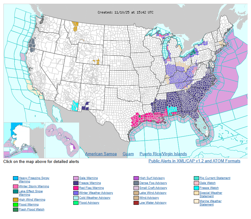
Freeze watches and warnings are in effect from the Lower Mississippi Valley to the Virginia Tidewater through Tuesday morning. High pressure diving south across the Plains will combine with a tight pressure gradient over the Mississippi Valley and Southeast, producing gusty winds and dry air. This will create an elevated fire danger across the Central Gulf Coast and Southern Plains, where Red Flag Warnings are in place.
In the Midwest and interior Northeast, cold northerly flow will generate steady snowfall. Accumulations of 4–8 inches—with isolated higher amounts—are expected across the Great Lakes and Appalachians through Wednesday morning. Lake Effect Snow Warnings are posted downwind of Lake Erie, with Winter Weather Advisories and Storm Warnings across parts of northern Maine and the Central to Southern Appalachians.
Farther west, another upper-level system will bring unsettled weather to the region beginning Wednesday.
WYOMING
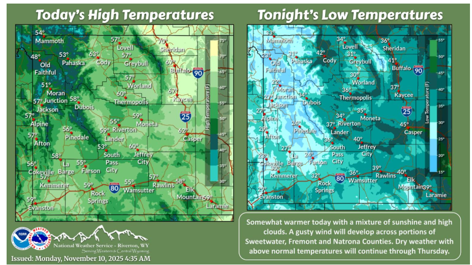
Warmer today with a mix of sunshine and clouds. A gusty wind will develop from Muddy Gap through Casper. Dry and mild weather continues through Thursday before cooler and wetter conditions may return.
Have a fantastic day.