
Sierra Nevada & West Coast
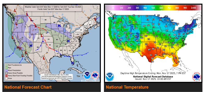
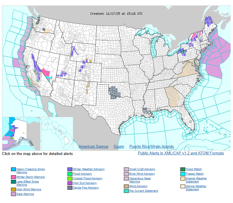
- Heavy snow is expected over the Sierra Nevada Mountains on Monday.
- A developing upper-level low along the California coast is sliding south toward Northwestern Mexico by Wednesday.
- This system will bring rain and isolated thunderstorms to the West Coast and Central California through early Tuesday.
- The Pacific Northwest will see rain and light mountain snow early Tuesday, tapering off by Wednesday.
- From Monday night through Wednesday morning, showers, thunderstorms, and high-elevation snow will impact parts of the Southwest.
Central Rockies, Plains & Midwest
- Low pressure over the Central Rockies will shift east toward the southern Ohio Valley by Tuesday night.
- Expect higher-elevation snow and lower-elevation rain across the Great Basin and Central Rockies from Monday into late Monday night.
- Scattered showers and thunderstorms will develop over the Northern and Central Plains, spreading into the Middle and Lower Mississippi Valley by Monday evening.
- By Tuesday morning, light snow is likely along the northern edge of the system across the Upper Mississippi Valley, Great Lakes, and into parts of the Ohio Valley.
- Rain and isolated thunderstorms will continue in the Ohio Valley on Tuesday and ease by Wednesday.
- Rain will also spread into the Central Appalachians and Mid-Atlantic Tuesday afternoon through Wednesday.
Northeast & Great Lakes
- An upper-level low will continue to produce lake-effect snow downwind of Lakes Erie and Ontario, ending overnight Monday.
- Snow will also impact parts of northeastern New York and the Northeastern Mountains, tapering off overnight Tuesday.
Southeast
- Onshore flow will bring scattered showers to southeast-central Florida from Monday night through Wednesday.
WYOMING
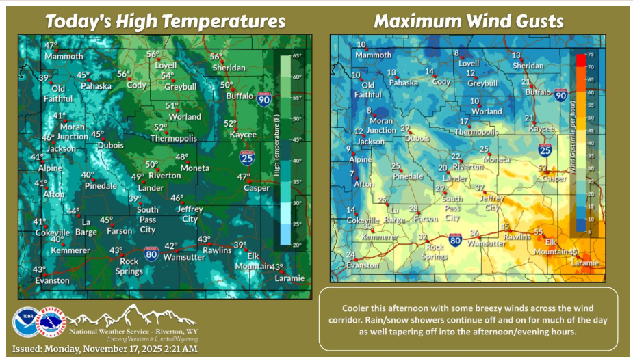
Cooler and wetter to start the work week. Gusty winds across I-80 to Natrona County with continued rain and snow showers for much of the day.
Have a fantastic day.