
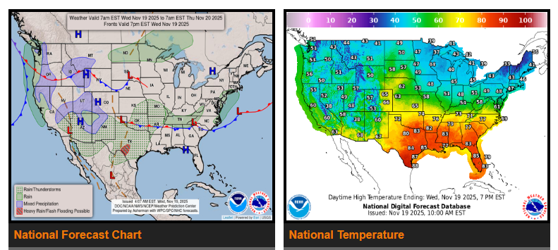
There is a slight risk of excessive rainfall in parts of the Southwest on Wednesday and in southern Texas on Thursday. Light snow is expected in the southern Utah Mountains, Colorado Mountains, and the Sierra Nevada.
On Wednesday, a low-pressure system will move from the Southwest into the Central and Southern Plains by Thursday, then toward southeastern Canada by Friday. This system will bring heavy rain and thunderstorms to the Southwest, along with rain and higher-elevation snow in the Central and Southern Rockies Wednesday night into Thursday. Localized flash flooding is possible, especially in urban areas, on roads, near small streams, and around burn scars.
Light snow will also develop Wednesday in the Sierra Nevada and southern Utah Mountains. Rain with embedded thunderstorms will spread across the Southern Rockies and Southern High Plains from Wednesday into Thursday.
By Thursday, heavy rain and thunderstorms will move into the Southern Plains and continue into the Middle and Lower Mississippi Valley. Flash flooding may occur in vulnerable areas such as urban zones, roads, small streams, canyons, and burn scars. Rain will also push into the Ohio Valley Thursday, expanding into the Central Appalachians and then the Mid-Atlantic/Northeast by Thursday night into Friday.
Another front approaching the West Coast on Wednesday will bring light rain to the Pacific Northwest and Northern California, spreading into Southern California on Thursday. By Friday, the system will shift toward northwestern Mexico, bringing rain and high-elevation snow to the Southwest from Thursday into Friday.
WYOMING
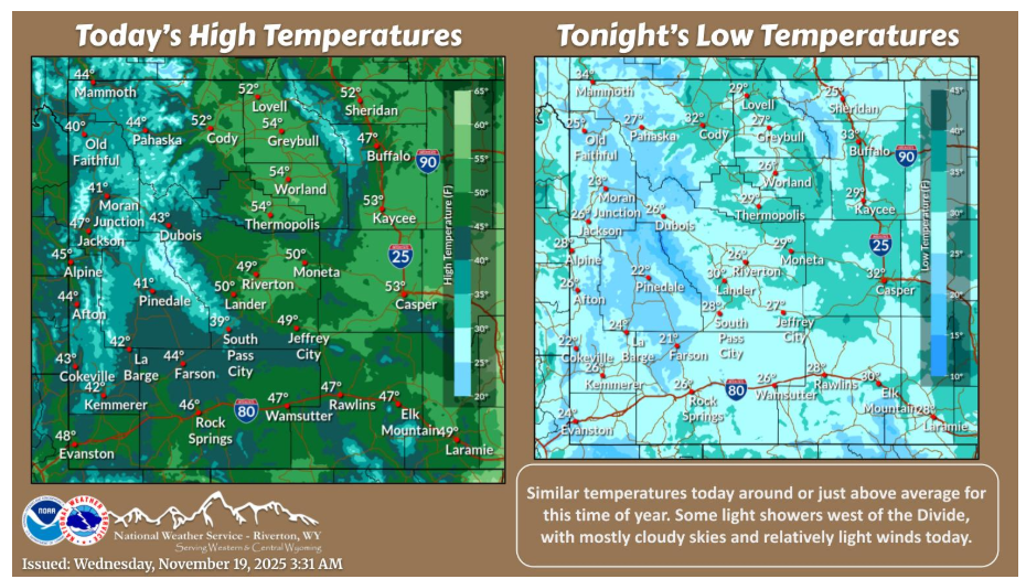
Seasonable temperatures for the most part this afternoon under mostly cloudy skies and relatively light winds. Some light showers west of the Divide with most remaining dry today.
Have a fantastic day.