
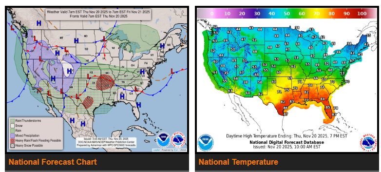
There is a Moderate Risk of excessive rainfall across parts of the Southern Plains, with a Slight Risk extending into Southern California, the Central and Southern Plains, and the Middle to Lower Mississippi Valley. Light snow is also expected in the higher elevations of southern Utah, Colorado, and the Sierra Nevada.
A strong system moving out of the Southwest will track toward the Tennessee Valley, pulling Gulf moisture north and producing heavy rain and thunderstorms across the Southern Plains. Flash flooding is likely in many areas, with streams and possibly larger rivers affected.
Heavy rain will also impact the Central/Southern Plains and the Middle/Lower Mississippi Valley, where localized flash flooding may occur—especially in urban areas, low spots, small streams, and roadways.
Farther north, the Upper Mississippi Valley and Upper Great Lakes can expect light rain as another low moves through the region.
Rain and thunderstorms will spread across the Tennessee and Ohio Valleys, then expand into the Central Appalachians, Mid-Atlantic, and eventually the Northeast before tapering off.
Along the West Coast, a front will bring light rain to the Pacific Northwest and California. Southern California will see periods of heavier rain as moisture continues to stream inland, creating a risk for localized flash flooding, especially near burn scars and smaller waterways.
As the storm moves farther inland, rain and high-elevation snow will develop across the Intermountain West. A separate weak system late in the period will bring additional light rain and mountain snow to the Pacific Northwest.
WYOMING
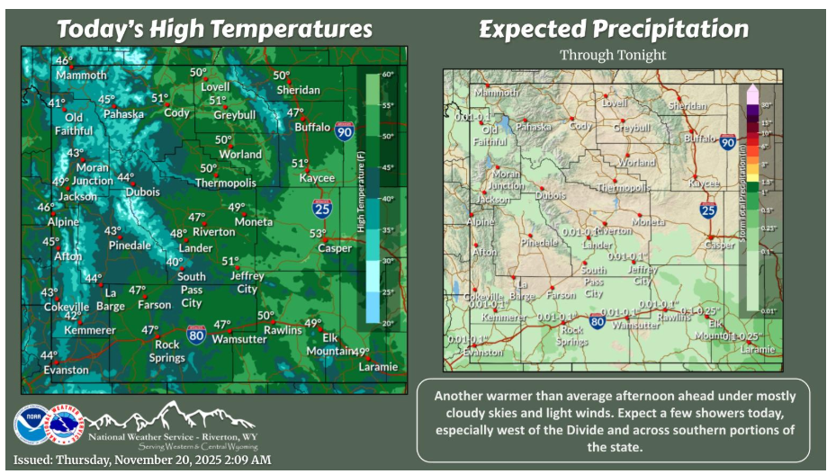
Areas of fog and low clouds will improve through the morning but remain partly to mostly cloudy in the afternoon. Some light showers west of the Divide and across the south but limited in accumulations. Warmer than average once again for this time of year with relatively light winds as well.
NEBRASKA
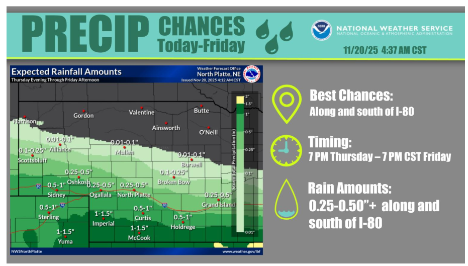
A storm system crosses the area this evening into tomorrow, bringing accumulating rain primarily to areas near and south of I-80. Amounts in excess of a half inch are possible for areas south of Highway 23, with lesser amounts northward into the Sandhills.
Have a fantastic day.