
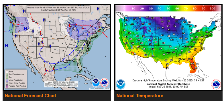
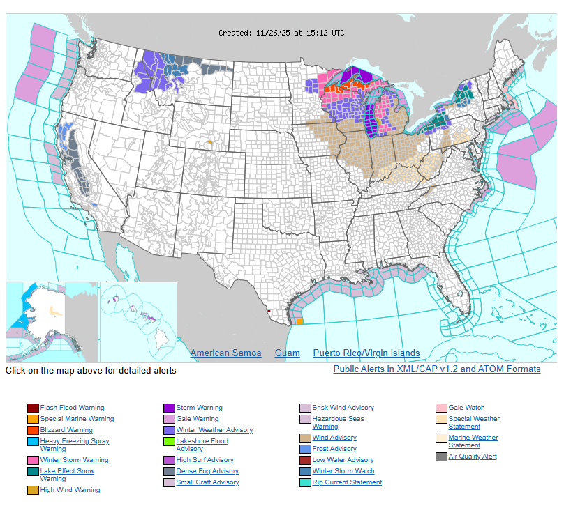
A strong storm system moving through the Great Lakes will bring blizzard conditions along the south shore of Lake Superior today. Heavy snowfall of over a foot is expected in the Arrowhead region, with dangerous winds and reduced visibility.
Across the rest of the Great Lakes, rain will change to snow through Thanksgiving morning. Windy conditions and lake-effect snow bands will continue into Friday, especially downwind of the lower Great Lakes. Snow in the upper Great Lakes will begin tapering off by Friday morning.
The eastern U.S. will start today mild with scattered showers and a chance of thunderstorms in the Southeast. New England will see rain ending this morning. Colder air will arrive later today and tonight as the storm’s cold front pushes east. Thanksgiving Day will be clearer but windy and much colder, with Maine seeing lingering wet snow early. Freezing temperatures may reach as far south as the FL Panhandle by Friday morning.
Meanwhile, the western U.S. stays milder than normal through the holiday. The Pacific Northwest will see periods of mountain snow and low-elevation rain over the next couple days as Pacific systems move inland. Montana may see increasing chances for snow Friday morning as colder air drops south and low pressure develops over the High Plains.
Storms in southern TX early today should gradually diminish as the cold front continues moving south.
WYOMING
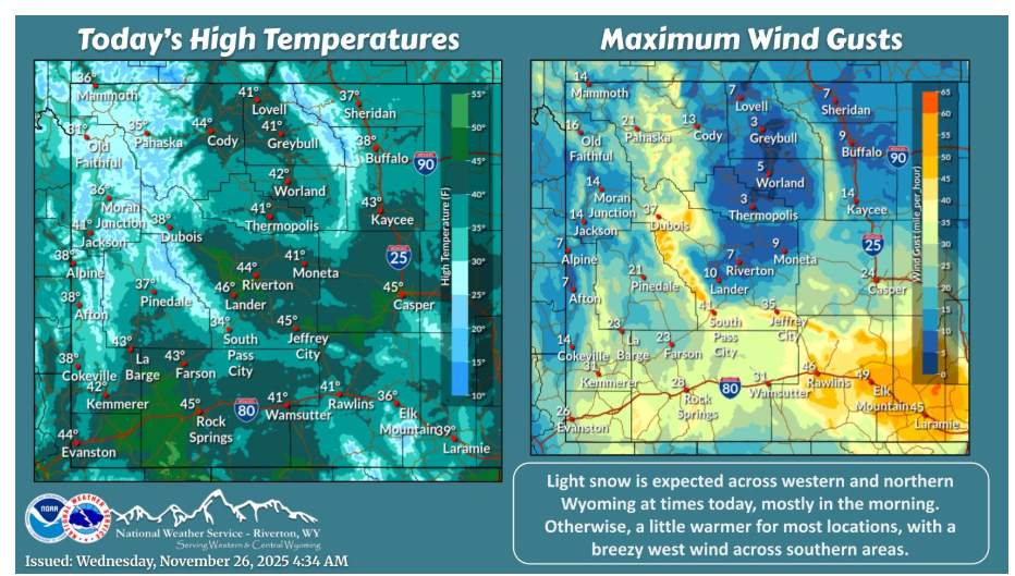
Light snow is expected across western and northern Wyoming at times today, mostly in the morning. Otherwise, a little warmer for most locations, with a breezy west wind across southern areas.
NEBRASKA
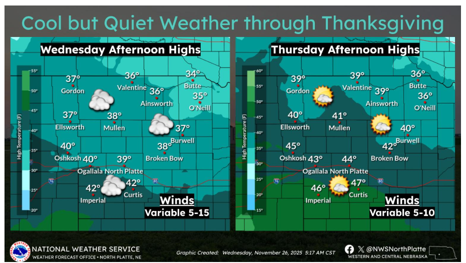
Cool but quiet weather continues into Thanksgiving. Highs will stay in the 30s and low 40s on Wednesday with light, variable winds. Most areas remain dry, though a few flurries are possible across the southern Panhandle into southwest Nebraska during the day. Thanksgiving looks pleasant for late November, with highs warming into the 40s under partly sunny skies and light winds.
Have a fantastic day.