
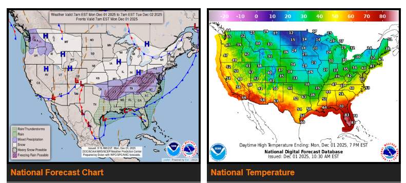
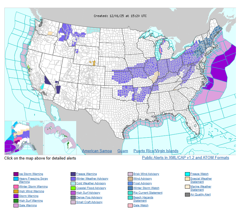
A messy wintry mix is expected Monday across the Ozarks and Mid-South into the Ohio Valley, with light to moderate snow for parts of the Midwest and Lower Great Lakes.
New England and the inland Mid-Atlantic will see their first major winter storm late Monday into Tuesday, bringing heavy snow and some significant icing.
Cold temperatures will continue across most of the eastern and central U.S.
Lingering snow showers will continue into Monday morning across the Great Lakes and interior Northeast as the weekend storm moves into southeastern Canada. The next system will quickly take shape over the Rockies and Plains, spreading rain, thunderstorms, and some heavier downpours across the Gulf Coast and Southeast. Isolated flash flooding is possible.
North of the storm, colder air will produce a wintry mix from the Ozarks/Mid-South through the Ohio Valley, with hazardous travel from snow and ice. Just to the north, a broad area of accumulating snow will stretch from the central Plains through the Middle Mississippi Valley into the Upper Ohio Valley and Lower Great Lakes.
As the storm strengthens along the East Coast late Monday into Tuesday, heavy snow is likely across inland New England and the Mid-Atlantic, with over 6 inches possible north and west of the I-95 corridor. Icing is expected in parts of the central and southern Appalachians.
Another system will move into the Pacific Northwest and northern Rockies Monday, bringing coastal rain and mountain snow. By Tuesday, snow will spread across the Great Basin and central Rockies. The northern Plains and Upper Great Lakes will also see periods of light to moderate snow from a quick-moving clipper system.
Temperatures will stay well below average across the eastern and central U.S., with highs in the:
- Teens and 20s for the northern Plains and Midwest
- 30s and 40s for the central Plains, Ohio Valley, Northeast, and Mid-Atlantic
- 40s and 50s across Texas and the Southeast
Warmer temps in the 60s will be found along the Gulf Coast and the Southeast south of the frontal boundary. The High Plains will warm into the 30s–60s on Tuesday due to downslope winds. The West remains near seasonal averages, with 40s inland, 50s–60s along the coast, and 60s–70s in the Desert Southwest.
WYOMING
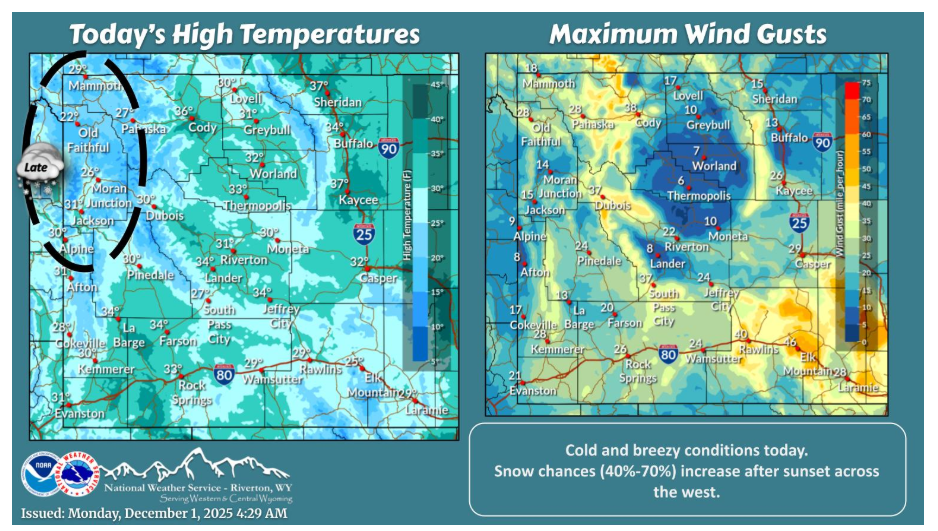
The first day of December brings near to slightly below normal temperatures with breezy winds. A weather system approaches the west after sunset and brings increasing snow chances to the west tonight. Snow chances become more widespread across the entire area on Tuesday.
Have a fantastic day!