
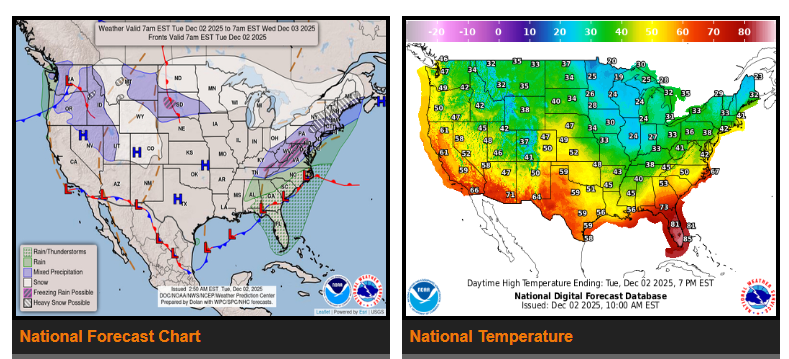
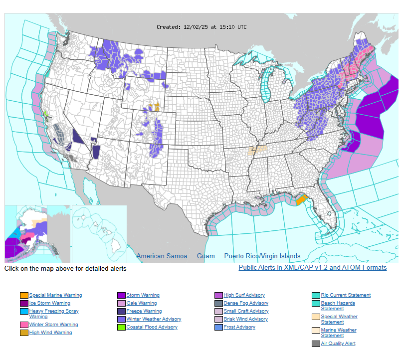
The first winter storm of the season continues across inland New England and the Mid-Atlantic, bringing heavy snow, icy roads, and hazardous conditions. Snowfall rates may reach 1 inch per hour, with totals of 5–10 inches and isolated areas over a foot. Icy conditions are possible this morning across the central and southern Appalachians. Areas along the I-95 corridor should expect mostly rain.
Across the Ohio Valley, Great Lakes, and interior New England, snow showers will continue through today before tapering off late tonight into Wednesday.
Further west, multiple systems are bringing snow to the Rockies, Great Basin, and Northern Plains, including moderate mountain snow and light accumulations in lower elevations. A clipper system will also bring snow to the Northern Plains and Upper Great Lakes through Wednesday, with lake-enhanced snow possible.
The eastern and central U.S. will stay well below normal, with highs mostly in the 20s–40s. The northern Plains may drop into the single digits behind the next cold front, with possible near-record lows Thursday morning. The West stays closer to average with highs in the 40s–60s, warmer in the Southwest.
WYOMING
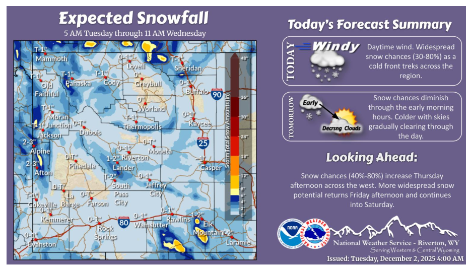
A cold front will trek across Wyoming today and will bring wind and widespread snow chances. Western Wyoming can expect snow most of the daylight hours today. Snow potential ramps up elsewhere during the afternoon and evening as the cold front moves through. Periods of moderate snow could cause reduced visibility and slick roads!
NEBRASKA
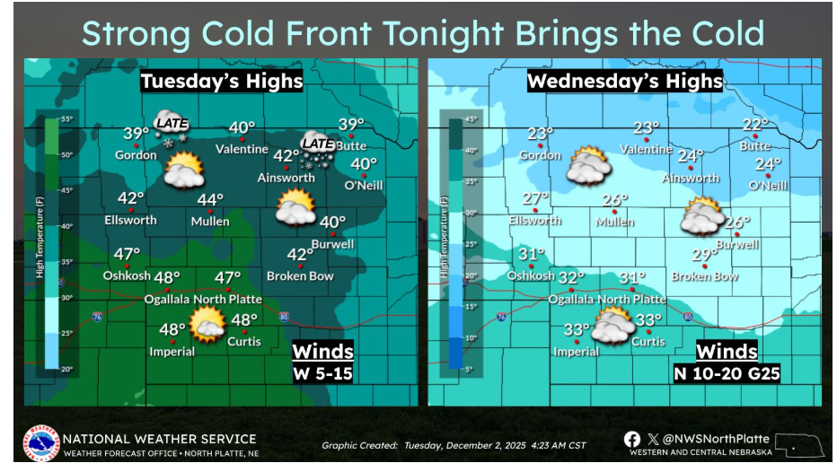
A strong cold front arrives late tonight, and we’re watching the potential for a light wintry mix or light snow across northern Nebraska just ahead of it. Behind the front, temperatures will tumble—Wednesday’s highs will occur early, with temperatures falling through the day and brisk north winds making it feel even colder. Make sure to bundle up tomorrow!
Have a fantastic day.