
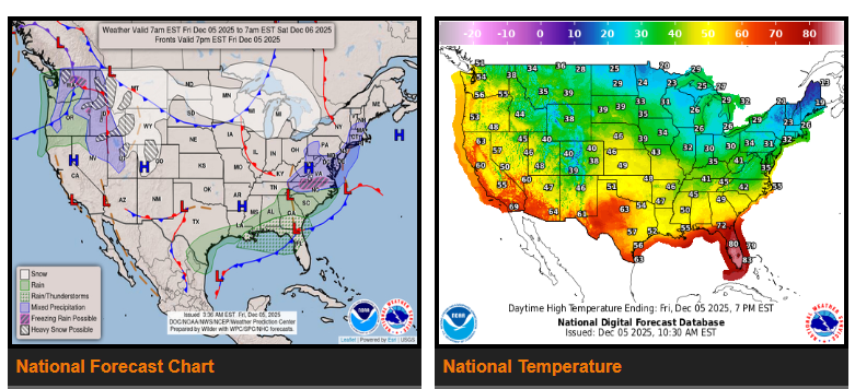
Active winter weather continues across several regions heading into the weekend. Snow is expected from the Mid-Atlantic to the Midwest and Rockies through Saturday. The Gulf Coast will see moderate to heavy rainfall, and temperatures will remain well below average from the northern Plains toward the East Coast.
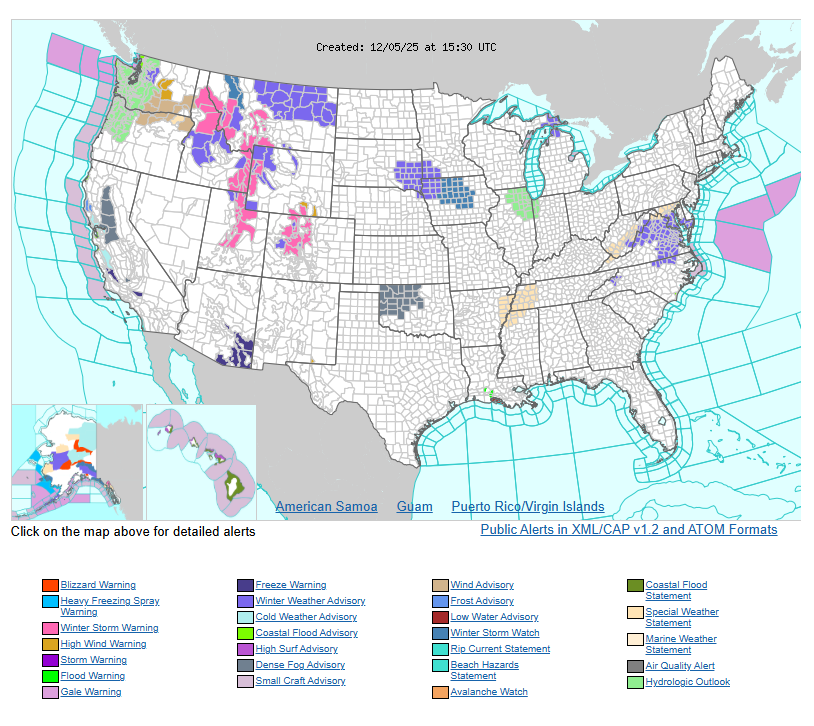
Light to moderate snow will continue in the Mid-Atlantic through Friday morning as a low moves from Georgia into the Carolinas. Expect 1–3 inches from the southern Appalachians into central Virginia, with lighter totals farther north. North Carolina will mainly see rain. Winter Weather Advisories remain in effect from eastern Kentucky to the Delmarva region.
A stronger Pacific storm will bring much heavier snowfall to the Northwest and northern Rockies. One to two feet of snow is likely in higher elevations from northern Idaho and western Montana to the Wasatch Range, western Wyoming, and parts of Colorado. Snow will taper off Saturday night. By Saturday afternoon into early Sunday, snow becomes more likely across the Dakotas, Iowa, and southern Minnesota.
Elsewhere, dry conditions persist from California across the southern Plains and into the Ohio Valley. Western Oregon and Washington will see periods of moderate to heavy rain through early Saturday. Along the Gulf Coast, a stalled front will keep rain chances high from southeast Louisiana to Florida and coastal South Carolina through early Sunday.
Very cold temperatures continue from the northern Plains to the Northeast, with arctic air bringing subzero lows in parts of the Dakotas and Minnesota by Sunday morning.
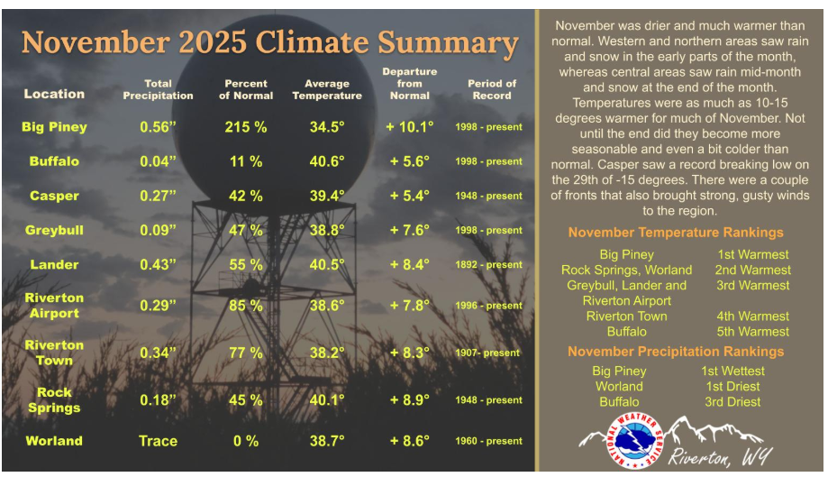
The month was much warmer than normal, with highs on many days of 10 to 15 degrees above normal. Snowfall and rain prevailed in the west in the early part of the month, then finally moved into the central regions. However, the month ended up on the drier side of normal. There were also several windy days across the Cowboy State. For more information out our local climate page.
Have a fantastic day.